Upleward
Village of Krummhörn in Lower Saxony, Germany

Coat of arms
Location of Upleward

53°25′18″N 7°02′43″E / 53.42166°N 7.04532°E / 53.42166; 7.04532
26736
Upleward (East Frisian Low Saxon: Plewert) is a village in the region of East Frisia, in Lower Saxony, Germany. It is part of the municipality of Krummhörn. The village is located between Hamswehrum and Campen.
Upleward is built on a warft which has been inhabited since at least the Early Middle Ages.[1] The village center consists of traditional single-family houses, built around the Gothic church from the 14th century.[2] The church's narrow pointed arches are typical of the time.[3]
In 2004, an iron dagger inscribed with the words "ANNA" and "HANA" was discovered in Upleward, dating back to 1450.[4]
Gallery
-
 Church of Upleward [de]
 -
 Gefallenendenkmal ('Memorial for the Fallen')
 -
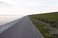 Dyke near Upleward


Notable people
- Johannes Bogerman (1576–1637), Dutch theologician
References
- ^ "Upleward". Wierden en terpen (in Dutch). Retrieved 17 October 2023.
- ^ "Evangelisch-reformierte Gemeinde Upleward". Reformiert.de (in German). Retrieved 17 October 2023.
- ^ Reese, Ines. "Upleward (2020): Kirche" (PDF). Ostfriesische Landschaft: Archäologischer Dienst - Forschungsinstitut.
- ^ König, Sonja. "Upleward (2010): Nierendolch des späten Mittelalters" (PDF). Ostfriesische Landschaft: Archäologischer Dienst - Forschungsinstitut.
External links
![]() Media related to Upleward at Wikimedia Commons
Media related to Upleward at Wikimedia Commons

 | This German location article is a stub. You can help Wikipedia by expanding it. |
- v
- t
- e


