Uhabia
Coastal river in Aquitaine, France
![Uhabia is located in France](http://upload.wikimedia.org/wikipedia/commons/thumb/f/f7/France_relief_location_map.jpg/240px-France_relief_location_map.jpg)
![Uhabia](http://upload.wikimedia.org/wikipedia/commons/thumb/0/0c/Red_pog.svg/8px-Red_pog.svg.png)
![Uhabia is located in Nouvelle-Aquitaine](http://upload.wikimedia.org/wikipedia/commons/thumb/2/2d/Aquitaine-Limousin-Poitou-Charentes_region_relief_location_map.jpg/240px-Aquitaine-Limousin-Poitou-Charentes_region_relief_location_map.jpg)
![Uhabia](http://upload.wikimedia.org/wikipedia/commons/thumb/0/0c/Red_pog.svg/8px-Red_pog.svg.png)
• location
• coordinates
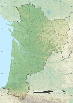
The Uhabia or Ouhabia is a coastal river of the French Basque Country, in Aquitaine, southwest France. It is 15.1 km (9.4 mi) long.[1]
Geography
![](http://upload.wikimedia.org/wikipedia/commons/thumb/f/f8/Bidart_Bassilour_Uhabia.jpg/220px-Bidart_Bassilour_Uhabia.jpg)
![](http://upload.wikimedia.org/wikipedia/commons/thumb/2/28/Uhabia_Embouchure_Bidart.jpg/220px-Uhabia_Embouchure_Bidart.jpg)
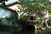
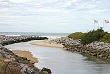
It rises at Goizbide in the woods above Ustaritz and Saint-Pée-sur-Nivelle, where it is known as the Apalagako erreka. It collects waters from the Alhorgako Erreka and drains the plain of Belhardi in the north of Ahetze, before flowing into the Bay of Biscay in Bidart.
Name
Its name Uhabia is the regular evolution of ur habia, that can be translated as "course of the water".
Main tributaries
- Barrandiko Erreka, from Othe Xuria
- Alhorgako Erreka, from Zirikolatz
Départements and towns
- Pyrénées-Atlantiques: Ustaritz, Arbonne, Bidart.
References
![](http://upload.wikimedia.org/wikipedia/en/thumb/4/4a/Commons-logo.svg/30px-Commons-logo.svg.png)
Wikimedia Commons has media related to Uhabia.
- v
- t
- e