| Site name | Photograph | B | G | Area[a] | Public access | Location[a] | Other classifications | Map[b] | Citation[c] | Description |
| Abberton Reservoir | 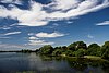 |  Y Y | | 718.3 hectares (1,775 acres) | PP | Layer de la Haye
51°49′30″N 0°51′43″E / 51.825°N 0.862°E / 51.825; 0.862 (Abberton Reservoir)
TL973179 | EWT,[13] NCR,[14] Ramsar,[15] SPA[16] | Map | Citation | This site is of international significance for wintering wigeons, and nationally important for twelve other waterfowl species, including mute swans, gadwalls, tufted ducks, goldeneyes and goosanders. It is also very unusual in having cormorants nesting in trees.[14] |
| Ardleigh Gravel Pit | 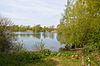 | | Y | 1.2 hectares (3.0 acres) | PP | Ardleigh
51°54′50″N 0°59′10″E / 51.914°N 0.986°E / 51.914; 0.986 (Ardleigh Gravel Pit)
TM055281 | GCR[17] | Map | Citation | This site exposes a number of interglacials, including one dated to the Hoxnian Stage around 400,000 years ago, and some much older. It also has a horizon with very rare plant micro-fossils dating to a cold period.[18] |
| Ashdon Meadows |  | Y | | 1.4 hectares (3.5 acres) | YES | Saffron Walden
52°02′10″N 0°19′05″E / 52.036°N 0.318°E / 52.036; 0.318 (Ashdon Meadows)
TL591401 | | Map | Citation | The site is unimproved grassland which is used for hay growing, with some areas calcareous and others neutral. It is the only known example of grassland on chalky boulder clay in north-west Essex. Flora includes salad burnet, downy oat-grass and fen bedstraw.[19] |
| Basildon Meadows | 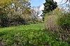 | Y | | 6.8 hectares (17 acres) | NO | Basildon
51°33′11″N 0°27′18″E / 51.553°N 0.455°E / 51.553; 0.455 (Basildon Meadows)
TQ703867 | | Map | Citation | The site is composed of three unimproved meadows which have a wide variety of herbs. Flowers include the green-winged orchid and yellow rattle, which are rare in Essex. There is also a small pond and scattered scrub.[20] |
| Belcher's and Broadfield Woods |  | Y | | 14.4 hectares (36 acres) | YES | Halstead
51°54′32″N 0°37′48″E / 51.909°N 0.630°E / 51.909; 0.630 (Belcher's and Broadfield Woods)
TL810267 | EWT[21][22] | Map | Citation | The site is coppice woodland on chalky boulder clay. There is a variety of woodlands types, such as wet ash and maple, and acid birch, ash and lime. The ground flora includes species which are locally uncommon, including greater butterfly-orchid and bird's-nest orchid.[23] |
| Benfleet and Southend Marshes |  | Y | | 2,373.7 hectares (5,866 acres) | PP | Southend-on-Sea
51°34′N 0°41′E / 51.57°N 0.68°E / 51.57; 0.68 (Benfleet And Southend Marshes)
TQ859842 | EWT,[24] LNR,[25] NCR,[26] NNR,[26] Ramsar,[15] SPA[27] | Map | Citation | The marshes and mudflats have internationally important numbers of wildfowl and waders, including the dark-bellied brent goose, grey plover, redshank and knot. Some areas are very important for scarce invertebrates, such as white-letter hairstreak and marbled white butterflies.[26] |
| Blackwater Estuary |  | Y | | 4,403.5 hectares (10,881 acres) | YES | Maldon
51°44′N 0°49′E / 51.74°N 0.81°E / 51.74; 0.81 (Blackwater Estuary)
TL943084 | EWT,[28][29] NCR,[30]NNR,[31] Ramsar,[15] SAC,[32] SPA[33] | Map | Citation | The estuary has internationally important numbers of wintering dark-bellied brent geese, ringed plover and dunlin, and nationally important numbers of nine species. There are sixteen invertebrates on the IUCN Red List of Threatened Species.[30] |
| Blake's Wood & Lingwood Common | 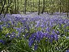 | Y | | 87.3 hectares (216 acres) | YES | Danbury
51°43′41″N 0°34′01″E / 51.728°N 0.567°E / 51.728; 0.567 (Blake's Wood & Lingwood Common)
TL774064 | NT[34] | Map | Citation | This site has a variety of heath, woodland and marsh habitats, and four of the woodland types are unusual in Britain. The woodlands have diverse bird species, and two unusual moths, the silver barred and rosy marbled, have been recorded on the common.[34] |
| Bovingdon Hall Woods |  | Y | | 71.3 hectares (176 acres) | NO | Braintree
51°55′41″N 0°33′18″E / 51.928°N 0.555°E / 51.928; 0.555 (Bovingdon Hall Woods)
TL758286 | | Map | Citation | The site is coppice woodland of medieval origin on chalky boulder clay. It has unusual woodland types, such as small-leaved lime and plateau alder. Other trees include sessile and peduculate oak, ash, maple and hornbeam, with occasional wild service tree.[35] |
| Bullock Wood |  | Y | | 23.5 hectares (58 acres) | NO | Colchester
51°54′43″N 0°56′02″E / 51.912°N 0.934°E / 51.912; 0.934 (Bullock Wood)
TM019278 | | Map | Citation | The site is mature coppice with a wide variety of trees. The main woodland type is hazel and sessile oak, which is rare nationally. The understorey is mainly coppiced hazel, and the ground flora is dominated by bramble and bracken.[36] |
| Canvey Wick |  | Y | | 93.2 hectares (230 acres) | YES | Canvey Island
51°31′19″N 0°32′10″E / 51.522°N 0.536°E / 51.522; 0.536 (=Canvey Wick)
TQ760834 | Buglife,[37] RSPB[37] | Map | Citation | Canvey Wick has a nationally important population of invertebrates, including 22 on the IUCN Red List of Threatened Species, and three which had been recorded as extinct in Britain. It also has a nationally important population of shrill carder bees. Scrub edges provide additional habitats.[38] |
| Cattawade Marshes |  | Y | | 89.2 hectares (220 acres) | NO | Manningtree
51°57′18″N 1°02′24″E / 51.955°N 1.040°E / 51.955; 1.040 (Cattawade Marshes)
TM090329 | DVAONB,[39] Ramsar,[40] RSPB,[41] SPA[39] | Map | Citation | The site is a marsh area between two arms of the River Stour. It is of major importance for breeding birds, especially waders and wildfowl, such as Shoveler, Teal, Tufted Duck and Water Rail. Other habitats are grassland and ditches.[42][43] |
| Chalkney Wood |  | Y | | 73.7 hectares (182 acres) | YES | Earls Colne
51°54′58″N 0°43′23″E / 51.916°N 0.723°E / 51.916; 0.723 (Chalkney Wood)
TL874277 | | Map | Citation | The ancient woodland is on acid silts and sands. Trees include, ash, lime birch and pedunculated oak. The ground layer is dominated by bramble, and other plants include primrose and wood anemone. The wood is divided by grassy rides, and there are over twenty ponds.[44] |
| Clacton Cliffs and Foreshore |  | | Y | 26.3 hectares (65 acres) | PP | Clacton-on-Sea
51°46′44″N 1°07′52″E / 51.779°N 1.131°E / 51.779; 1.131 (Clacton Cliffs and Foreshore)
TM161136 | GCR[45] | Map | Citation Archived 2016-03-04 at the Wayback Machine | This site dates to the warm Hoxnian Stage around 400,000 years ago. Flint tools found there have made it the type site for the Clactonian, a core-and-flake industry of homo erectus, although paleontologists disagree whether it is really a separate industry from the Acheulian.[46][47] |
| The Cliff, Burnham-on-Crouch |  | | Y | 3.8 hectares (9.4 acres) | YES | Burnham-on-Crouch
51°38′10″N 0°46′30″E / 51.636°N 0.775°E / 51.636; 0.775 (The Cliff, Burnham-On-Crouch)
TQ921967 | GCR[48][49] | Map | Citation | Fossils birds dating to the Lower Eocene, around 55 to 48 million years ago, have been found at this site, and it has yielded the type material of two species. Considerable quantities of fossil fishes have also been found, mainly sharks, and it is the type locality for several species.[50] |
| Colne Estuary |  | Y | Y | 2,986.5 hectares (7,380 acres) | YES | Brightlingsea
51°49′N 0°59′E / 51.81°N 0.99°E / 51.81; 0.99 (Colne Estuary)
TM062161 | EWT[51] GCR,[52] NCR,[51] NNR,[51] Ramsar,[15] SAC,[32] SPA[53] | Map | Citation | The site has varied habitats, such as saltmarsh, mud flats, shingle spits and former gravel pits. It is of international importance for wintering brent geese and black-tailed godwits, and of national importance for six other bird species, including little terns.[51] |
| The Coppice, Kelvedon Hatch |  | Y | | 9.3 hectares (23 acres) | NO | Kelvedon Hatch
51°40′12″N 0°16′23″E / 51.67°N 0.273°E / 51.67; 0.273 (The Coppice, Kelvedon Hatch)
TQ573992 | | Map | Citation | The site is an ancient semi-natural wood in the valley of a small tributary of the River Roding. It is base-rich alder on the valley floor, and oak and hornbeam in other areas. The geology is complex, with areas of Claygate Beds and Bagshot Beds.[54] |
| Cornmill Stream and Old River Lea |  | Y | | 25.1 hectares (62 acres) | YES | Waltham Abbey
51°41′35″N 0°00′22″W / 51.693°N 0.006°W / 51.693; -0.006 (Cornmill Stream and Old River Lea)
TL379012 | | Map | Citation | The slow-moving Cornmill Stream and Old River Lea form a freshwater habitat with one of the most diverse invertebrate fauna in Essex. Eighteen species of dragonflies and damselflies have been recorded, including the uncommon and nationally declining white-legged damselfly.[55] |
| Crouch and Roach Estuaries |  | Y | | 1,729.1 hectares (4,273 acres) | YES | Burnham-on-Crouch
51°37′N 0°44′E / 51.62°N 0.73°E / 51.62; 0.73 (Crouch and Roach Estuaries)
TQ889953 | EWT[56][57][58][59] Ramsar,[15] SAC,[32] SPA[60] | Map | Citation | The site is internationally important for wintering dark-bellied brent geese, and nationally important for black-tailed godwits, shelducks and shoveler ducks. There are invertebrates on the IUCN Red List of Threatened Species, such as the ground lackey moth, and dense populations of the nationally scarce Roesel's bush-cricket.[61] |
| Curtismill Green |  | Y | | 47.8 hectares (118 acres) | YES | Epping
51°38′42″N 0°11′35″E / 51.645°N 0.193°E / 51.645; 0.193 (Curtismill Green)
TQ518963 | | Map | Citation | This is unimproved grassland and scrub with both damp and dry areas, with a number of uncommon species. Notable plant species in grassland areas include Orange Foxtail, Lesser Spearwort and Yellow Rattle.[62] |
| Danbury Common |  | Y | | 71.0 hectares (175 acres) | YES | Danbury
51°42′32″N 0°34′41″E / 51.709°N 0.578°E / 51.709; 0.578 (Danbury Common)
TL782043 | EWT,[63][64] NT[65] | Map | Citation | The common is one of the largest areas of heathland left in the county, and also has bracken and gorse scrub, and woodland with oak and birch. Upper parts are on glacial gravel, and lower down there is boggy heath. This is the main British site for the rosy marbled moth.[64] |
| Debden Water |  | Y | | 21.3 hectares (53 acres) | YES | Newport
51°58′59″N 0°13′55″E / 51.983°N 0.232°E / 51.983; 0.232 (Debden Water)
TL534340 | | Map | Citation | The flood plain of the stream has tall fen vegetation, mainly common reed, while in some areas plants such as tussock sedge and lesser pond-sedge are locally dominant. Other habitats are neutral grassland, broad-leaved woodland and species-rich calcareous grassland.[66] |
| Dengie | 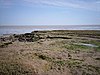 | Y | Y | 3,132.4 hectares (7,740 acres) | YES | Bradwell-on-Sea
51°41′N 0°57′E / 51.69°N 0.95°E / 51.69; 0.95 (Dengie)
TM042037 | EWT,[67] GCR,[68] NCR,[69] NNR,[31] Ramsar,[15] SAC,[32] SPA[70] | Map | Citation | This is a large area of tidal mudflats and salt marshes. It has internationally important winter populations of brent geese and grey plovers, and nationally significant numbers of knots, dunlins and turnstones.[69] |
| Elsenham Woods |  | Y | | 44.4 hectares (110 acres) | NO | Elsenham
51°54′22″N 0°16′05″E / 51.906°N 0.268°E / 51.906; 0.268 (Elsenham Woods)
TL561255 | | Map | Citation | The site comprises two separate areas, the larger Eastend Wood and the smaller Plegdon Wood. They are both ancient mixed woods on chalky boulder clay. There are also damp grass rides and ponds which provide additional habitats for invertebrates and birds.[71] |
| Epping Forest |  | Y | | 1,787.9 hectares (4,418 acres) | YES | Epping
51°39′N 0°03′E / 51.65°N 0.05°E / 51.65; 0.05 (Epping Forest)
TQ418971 | EWT,[72] NCR,[72] SAC,[73] SM[74][75] | Map | Citation | The site has ancient semi-natural woodland, grassland and wetland. The inverebrate fauna is described by Natural England as "of outstanding national significance", including 66 subcortical (under bark) and dead wood fauna on the IUCN Red List of Threatened Species.[72] |
| Foulness | 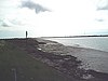 | Y | | 10,946.1 hectares (27,048 acres) | PP | Foulness
51°34′N 0°55′E / 51.57°N 0.92°E / 51.57; 0.92 (Foulness)
TR022902 | EWT,[76] LNR,[77] NCR,[9] Ramsar,[15] SAC,[78] SPA[79] | Map | Citation | This coastland site is of international importance for nine species of wildfowl and waders, such as dark-bellied brent geese. Rare plants include soft hornwort and spiral tasselwood, and the site is also important for invertebrates, with 71 nationally rare species.[9] |
| Garnetts Wood and Barnston Lays |  | Y | | 25.0 hectares (62 acres) | YES | Great Dunmow
51°50′17″N 0°22′23″E / 51.838°N 0.373°E / 51.838; 0.373 (Garnetts Wood / Barnston Lays)
TL636182 | | Map | Citation | The site is coppiced woodland, mostly ancient, on glacial silt, sands, gravels and clay soils. It contains some of the best lime woodland in the county. There are two ponds, which have the unusual water purslane.[80] |
| Garrold's Meadow |  | Y | | 5.0 hectares (12 acres) | NO | Leigh-on-Sea
51°34′05″N 0°37′44″E / 51.568°N 0.629°E / 51.568; 0.629 (Garrold's Meadow)
TQ823887 | | Map | Citation | This site is unimproved grassland on gravel in it southern part and clay in the north. There is also an area of marsh. The plant community is diverse, with a number of uncommon species. Grasses include common bent, sweet vernal grass and crested dog's-tail.[81] |
| Glemsford Pits |  | Y | | 33.2 hectares (82 acres) | PP | Glemsford
52°05′06″N 0°40′52″E / 52.085°N 0.681°E / 52.085; 0.681 (Glemsford Pits)
TL838463 | | Map | Citation | Thirteen species of dragonfly and damselfly have been recorded in these former gravel workings, including one which is rare in Britain, the ruddy darter dragonfly. Aquatic plants include the yellow water-lily and mare's tail.[82] |
| Globe Pit |  | | Y | 0.4 hectares (0.99 acres) | NO | Little Thurrock
51°28′44″N 0°20′20″E / 51.479°N 0.339°E / 51.479; 0.339 (Globe Pit)
TQ625782 | GCR[83] | Map | Citation | Natural England describes Globe Pit as "an important site for the interrelationship of archaeology with geology since it is vital in the correlation of the Lower Palaeolithic chronology with the Pleistocene Thames Terrace sequence". There are many Clactonian flint tools.[84] |
| Goldsands Road Pit | 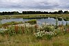 | | Y | 1.2 hectares (3.0 acres) | NO | Southminster
51°39′22″N 0°49′55″E / 51.656°N 0.832°E / 51.656; 0.832 (Goldsands Road Pit)
TQ960990 | GCR[85] | Map | Citation | This site provides the earliest evidence of an ancient course of the combined Thames and Medway rivers, which flowed north-east across eastern Essex in the late Anglian period around 400,000 years ago.[86] |
| Grays Thurrock Chalk Pit |  | Y | | 17.3 hectares (43 acres) | YES | Grays
51°29′10″N 0°18′58″E / 51.486°N 0.316°E / 51.486; 0.316 (Grays Thurrock Chalk Pit)
TQ609789 | EWT[87][88] | Map | Citation | This former chalk pit has a range of woodland, grassland and scrub habitats which are important for invertebrates. Beetles include two species on the IUCN Red List of Threatened Species, Mordellistena humeralis and Mordellistena neuwaldeggiana.[89] |
| Great Wood and Dodd's Grove | 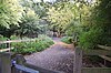 | Y | | 37.1 hectares (92 acres) | YES | Leigh-on-Sea
51°33′32″N 0°37′23″E / 51.559°N 0.623°E / 51.559; 0.623 (Great Wood and Dodd's Grove)
TQ819877 | EWT,[90] LNR[91] | Map | Citation | This is a small remnant of the ancient Hadleigh Great Wood. It is coppiced oak woodland on sands, gravels and clay, and one of the largest areas of old woodland in the south of the county. Plants include the rare broad-leaved helleborine.[91] |
| Hainault Forest |  | Y | | 135.3 hectares (334 acres) | YES | Lambourne
51°37′23″N 0°08′02″E / 51.623°N 0.134°E / 51.623; 0.134 (Hainault Forest)
TQ478937 | | Map | Citation | The woodland and scrub in this country park have varied flora and fauna, including diverse breeding birds. The shrub layer has plants such as wood sorrel and butcher's-broom, and birds include wood warblers and spotted flycatchers.[92] |
| Hales and Shadwell Woods |  | Y | | 15.4 hectares (38 acres) | PP | Saffron Walden
52°02′35″N 0°17′28″E / 52.043°N 0.291°E / 52.043; 0.291 (Hales and Shadwell Woods)
TL572408 | EWT,[93] NCR,[94] NNR[31] | Map | Citation | The woods are ancient coppice wet ash and maple on chalky boulder clay. The shrub layer is diverse, with plants including the wayfaring-tree and the nationally uncommon oxlip. Seven species of orchid have been recorded in Shadwell Wood, which also has herb-rich grassy rides.[95] |
| Hall's Quarry |  | | Y | 0.7 hectares (1.7 acres) | NO | Elsenham
51°55′44″N 0°12′22″E / 51.929°N 0.206°E / 51.929; 0.206 (Hall's Quarry)
TL518279 | GCR[96] | Map | Citation | The site exposes glacial gravels, silts and tills deposited during the Anglian ice age around 450,000 years ago. It is described by Natural England as "extremely important for the study of the Anglian glaciation and its associated deposits".[97] |
| Hamford Water | 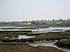 | Y | | 2,188.6 hectares (5,408 acres) | PP | Walton-on-the-Naze
51°53′N 1°14′E / 51.88°N 1.24°E / 51.88; 1.24 (Hamford Water)
TM230253 | EWT,[98][99][100] NCR,[98] NNR,[31] Ramsar,[15] SPA[101] | Map | Citation | The site is a tidal inlet which has marsh grasslands, creeks, mud and sand flats, salt marshes, islands and beaches. It is internationally significant for breeding little terns and wintering dark-bellied brent geese. Rare plants include hog's fennel and slender hare's-ear.[98] |
| Hangman's Wood and Deneholes |  | Y | | 5.2 hectares (13 acres) | YES | Little Thurrock
51°29′20″N 0°20′46″E / 51.489°N 0.346°E / 51.489; 0.346 (Hangman's Wood and Deneholes)
TQ630793 | SM[102] | Map | Citation | The deneholes, which were created by medieval chalk mining, are the most important underground hibernation sites for bats in Essex, with three species; Brown long-eared bat, Natterer's bat and Daubenton's bat. The oak woodland is ancient, and it provides a feeding habitat for the bats.[11] |
| Hanningfield Reservoir |  | Y | | 402.9 hectares (996 acres) | YES | Chelmsford
51°39′22″N 0°30′04″E / 51.656°N 0.501°E / 51.656; 0.501 (Hanningfield Reservoir)
TQ731982 | BSO,[103] EWT[104] | Map | Citation | The reservoir has a nationally important population of gadwalls, and it also has significant numbers of pochards, teal, tufted ducks and pintails. The chalk sludge lagoon has several unusual plants, and there is a rare moss Brachythecium mildeanum at the foot of the southern dam.[105] |
| Harlow Woods |  | Y | | 45.2 hectares (112 acres) | YES | Harlow
51°44′24″N 0°05′02″E / 51.74°N 0.084°E / 51.74; 0.084 (Harlow Woods)
TL440066 | LNR[106][107] | Map | Citation | The woods are mainly pedunculate oak and hornbeam, and other trees include ash, hazel and birch. There are also some elms which are regenerating from coppice following Dutch elm disease.[106] |
| Harwich Foreshore | 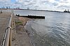 | | Y | 10.3 hectares (25 acres) | YES | Harwich
51°56′24″N 1°17′28″E / 51.940°N 1.291°E / 51.940; 1.291 (Harwich Foreshore)
TM263320 | GCR[108] | Map | Citation | This site exposes bands of ash from explosive volcanoes in Scotland during the Eocene epoch around 50 million years ago. It also has many London Clay fossils from the Eocene rainforest, including mammals such as Hyracotherium, the earliest ancestor of the horse.[109] |
| Hatfield Forest |  | Y | | 410.8 hectares (1,015 acres) | YES | Bishop's Stortford
51°51′22″N 0°13′37″E / 51.856°N 0.227°E / 51.856; 0.227 (Hatfield Forest)
TL535198 | NCR,[94] NNR,[31] NT,[110] SM,[111] | Map | Citation | This is the last Royal Forest to remain nearly intact. It has ancient coppice woodland, scrub, unimproved grassland, a large lake and extensive marshes. The woodland is mainly wet ash and maple. There are many rare plants and over sixty bird species.[112] |
| High Wood, Dunmow |  | Y | | 41.5 hectares (103 acres) | NO | Great Dunmow
51°52′23″N 0°19′37″E / 51.873°N 0.327°E / 51.873; 0.327 (High Wood, Dunmow)
TL603219 | | Map | Citation | The site on boulder clay and loess has areas of wet ash and maple woodland, and others of pedunculate oak and hornbeam. Some areas are ancient woodland. There is a diverse layer of ground flora, and damp woodland rides provide additional habitat for birds and invertebrates.[113] |
| Hockley Woods |  | Y | | 92.1 hectares (228 acres) | YES | Hockley
51°35′38″N 0°38′35″E / 51.594°N 0.643°E / 51.594; 0.643 (Hockley Woods)
TQ832917 | LNR[114] | Map | Citation | The woods are on pre-glacial gravels and clay, with trees including hornbeam, pedunculate oak, sessile oak, birch and hazel. Ground flora include three species of orchid, and there is a stream and area of bog.[115] |
| Holehaven Creek |  | Y | | 272.8 hectares (674 acres) | YES | Canvey Island
51°31′19″N 0°31′30″E / 51.522°N 0.525°E / 51.522; 0.525 (Holehaven Creek)
TQ753834 | | Map | Citation | The creek's intertidal marshes and mudflats support nationally important (and occasionally internationally) numbers of wintering black-tailed godwits. Curlews and dunlins are also sometimes present in nationally significant numbers.[116] |
| Holland Haven Marshes |  | Y | | 210.6 hectares (520 acres) | PP | Clacton-on-Sea
51°48′58″N 1°12′29″E / 51.816°N 1.208°E / 51.816; 1.208 (Holland Haven Marshes)
TM212179 | LNR[117] | Map | Citation | A network of ditches radiates from Holland Brook. These ditches have several nationally scarce aquatic plant species, such as brackish water crowfoot and divided sedge. There are also rare invertebrates, including one on the IUCN Red List of Threatened Species, the soldier fly Stratiomys singularior.[118] |
| Holland-on-Sea Cliff |  | | Y | 0.1 hectares (0.25 acres) | YES | Clacton-on-Sea
51°48′14″N 1°12′22″E / 51.804°N 1.206°E / 51.804; 1.206 (Holland-On-Sea Cliff)
TM211166 | GCR[119] | Map | Citation | This is the type site for the "Lower Holland Gravel", which was laid down by the River Thames before the river was diverted south during the Anglian glaciation around 450,000 years ago, and also for the "Upper Thames Gravel", which was deposited when the Thames was blocked by ice.[10] |
| Hunsdon Mead |  | Y | | 34.2 hectares (85 acres) | YES | Harlow
51°46′44″N 0°03′14″E / 51.779°N 0.054°E / 51.779; 0.054 (Hunsdon Mead)
TL418109 | EWT,[120] HMWT[121] | Map | Citation | This is unimproved grassland which is subject to winter flooding. Notable grass species include meadow brome and the quaking grass Briza media, and there are other unusual flora such as pepper saxifrage and green-winged orchid.[122] |
| Inner Thames Marshes |  | Y | | 485.9 hectares (1,201 acres) | YES | Purfleet
51°30′00″N 0°12′14″E / 51.500°N 0.204°E / 51.500; 0.204 (Inner Thames Marshes)
TQ531802 | RSPB[123] | Map | Citation | The marshes have a diverse bird population, including internationally important numbers of wintering teal. There are nationally scarce invertebrates such as the water beetles agabus conspersus and haliplus apicalis, the scarce emerald damselfly, and the meniscus midge dixella attica.[124] |
| Lion Pit |  | | Y | 2.4 hectares (5.9 acres) | YES | Grays
51°28′44″N 0°17′53″E / 51.479°N 0.298°E / 51.479; 0.298 (Lion Pit)
TQ597781 | EWT,[87][88] GCR[125] | Map | Citation | Evidence has been found on this site of flint-knapping using the Levallois technique by Neanderthals 200,000 years ago, and it has even been possible to fit back together some of the flint flakes. Fossils have been found of mammals including, rhinoceros, bison, mammoth and straight-tusked elephant.[12] |
| Little Hallingbury Marsh |  | Y | | 4.5 hectares (11 acres) | NO | Little Hallingbury
51°49′59″N 0°09′43″E / 51.833°N 0.162°E / 51.833; 0.162 (Little Hallingbury Marsh)
TL491171 | | Map | Citation | The site is unimproved wet grassland and fen, which contains uncommon and declining swamp plant species. The site is also of interest for over-wintering birds and aquatic insects, especially dragonflies.[126] |
| Little Oakley Channel Deposit |  | | Y | 3.0 hectares (7.4 acres) | NO | Little Oakley
51°55′16″N 1°13′52″E / 51.921°N 1.231°E / 51.921; 1.231 (Little Oakley Channel Deposit)
TM223296 | GCR[127] | Map | Citation | This site exposed a former channel of the River Thames during an interglacial period around 575,000 years ago. Many fossils were found, including rhinoceros and an extensive pollen record, allowing geologists to reconstruct the fauna and flora.[128] |
| Lofts Farm Pit |  | | Y | 5.0 hectares (12 acres) | NO | Maldon
51°45′00″N 0°41′56″E / 51.75°N 0.699°E / 51.75; 0.699 (Lofts Farm Pit)
TL864091 | GCR[129] | Map | Citation | Many fossils have been found dating to the last Ice Age, 110,000 to 12,000 years ago. Finds included reindeer, woolly mammoth and woolly rhinoceros. The site is in the "Blackwater Terrace Gravel", dating to a time when the River Blackwater was a tributary of the Thames-Medway River.[130] |
| Maldon Cutting |  | | Y | 0.2 hectares (0.49 acres) | NO | Maldon
51°43′44″N 0°39′50″E / 51.729°N 0.664°E / 51.729; 0.664 (Maldon Cutting)
TL841067 | GCR[131] | Map | Citation | The site is a former railway cutting which is the type locality for the Maldon Till, which dates to the Pleistocene ice age. It was previously thought to represent a separate advance of the ice sheet, but in the light of later work it was concluded that it is an outlier of the till which covers much of central and northern Essex.[132] |
| Marks Tey Brickpit |  | | Y | 29.8 hectares (74 acres) | NO | Marks Tey
51°52′59″N 0°46′30″E / 51.883°N 0.775°E / 51.883; 0.775 (Marks Tey Brickpit)
TL911242 | GCR[133] | Map | Citation | This site has a record of pollen throughout the Hoxnian interglacial around 400,000 years ago, and this is the best vegetational record for any British interglacial site. Seasonal layers in lake sediments have made it possible to estimate the duration of the Hoxnian.[134] |
| Mill Meadows, Billericay |  | Y | | 6.8 hectares (17 acres) | YES | Billericay
51°37′16″N 0°25′37″E / 51.621°N 0.427°E / 51.621; 0.427 (Mill Meadows, Billericay)
TQ681941 | LNR[135] | Map | Citation | Five sloping fields on London Clay are separated by old hedge lines. Some areas are wet, and the main grasses are red fescue and common bent. Flowers include harebell and common spotted orchid, and there are herbs such as pignut.[136] |
| Mucking Flats and Marshes |  | Y | | 312.7 hectares (773 acres) | PP | Tilbury
51°29′06″N 0°26′38″E / 51.485°N 0.444°E / 51.485; 0.444 (Mucking Flats and Marshes)
TQ698791 | Ramsar,[137] SPA[138] | Map | Citation | Wildfowl and waders feed and roost on the mudflats and marshes, with internationally important numbers of ringed plover, and nationally significant shelducks, grey plovers, dunlins, black-tailed godwits and redshanks.[139] |
| The Naze |  | | Y | 24.9 hectares (62 acres) | YES | Walton-on-the-Naze
51°51′54″N 1°17′24″E / 51.865°N 1.290°E / 51.865; 1.290 (The Naze)
TM266236 | GCR[140] | Map | Citation | This is the type site for the Waltonian, the first British stage of the Pleistocene. It also has many plant and bird fossils dating to the Eocene, and it is described by Natural England as important in the study of avian evolution.[141] |
| Newney Green Pit | 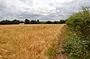 | | Y | 0.1 hectares (0.25 acres) | NO | Writtle
51°43′55″N 0°23′06″E / 51.732°N 0.385°E / 51.732; 0.385 (Newney Green Pit)
TL648064 | GCR[142] | Map | Citation | This former quarry exposed the Kesgrave (Thames) Gravel, dating to the Cromerian interglacial around 500,000 years ago. Higher layers displayed the transition from this warm period to the succeeding severe Anglian ice age.[143] |
| Norsey Wood |  | Y | | 65.6 hectares (162 acres) | YES | Billericay
51°37′55″N 0°26′10″E / 51.632°N 0.436°E / 51.632; 0.436 (Norsey Wood)
TQ687954 | LNR,[144] SM[145] | Map | Citation | This is ancient oak woodland on acid soil which has been converted to mixed sweet chestnut coppice. There are sphagnum mosses in acidic flushes, and the rare water violet in one of the four ponds. There are nine species of dragonfly.[146] Archaeological features include a Bronze Age bowl barrow.[145] |
| Nunn Wood | 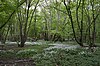 | Y | | 9.5 hectares (23 acres) | YES | Saffron Walden
52°03′43″N 0°16′37″E / 52.062°N 0.277°E / 52.062; 0.277 (Nunn Wood)
TL562429 | | Map | Citation | The site is an ancient coppice wood on chalky boulder clay. It is mainly hornbeam with other trees such as pedunculate oak, ash and field maple. Flowers include the nationally uncommon oxlip, and one of the largest colonies of early purple orchids.[147] |
| Pitsea Marsh |  | Y | | 92.3 hectares (228 acres) | PP | Pitsea
51°33′04″N 0°30′25″E / 51.551°N 0.507°E / 51.551; 0.507 (Pitsea Marsh)
TQ739866 | | Map | Citation | The site has a variety of habitats, such as grassland, scrub, reedbed, fen, ponds and saltmarsh. Dykes and ponds support the scarce emerald damselfly, and other rare invertebrates include Roesel's bush-cricket and the hoverfly xanthandrus comtus.[148] |
| Purfleet Chalk Pits | 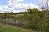 | | Y | 9.8 hectares (24 acres) | PP | Purfleet
51°28′59″N 0°15′00″E / 51.483°N 0.25°E / 51.483; 0.25 (Purfleet Chalk Pits)
TQ563784 | GCR[149] | Map | Citation | The chalk pits expose sands and gravels which are associated with the ancient course of the River Thames.[150] The site has been occupied by early humans at several different periods,[151] and MIS9, between about 335,000 and 280,000 years ago, is often informally called the Purfleet interglacial.[152] |
| Purfleet Road, Aveley |  | | Y | 4.0 hectares (9.9 acres) | YES | Aveley
51°29′46″N 0°14′20″E / 51.496°N 0.239°E / 51.496; 0.239 (Purfleet Road, Aveley)
TQ555798 | | Map | Citation | This site dates to the interglacial period, MIS7, around 200,000 years ago. It has yielded mollusc insect and mammal fossils, including the first jungle cat discovered in Britain.[153] |
| Quendon Wood | 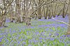 | Y | | 33.5 hectares (83 acres) | PP | Stansted Mountfitchet
51°56′46″N 0°12′18″E / 51.946°N 0.205°E / 51.946; 0.205 (Quendon Wood)
TL516298 | | Map | Citation | The site has ancient coppiced woods with a rich variety of fauna on different types of soil. It is mainly pedunculate oak/hornbeam woodland, with some areas having ash/maple, and others the rare birch/hazel variant. Plants in the understorey include wild daffodils and herb-paris.[154] |
| Riddles Wood |  | Y | | 37.9 hectares (94 acres) | NO | Clacton-on-Sea
51°49′12″N 1°05′17″E / 51.820°N 1.088°E / 51.820; 1.088 (Riddles Wood)
TM129180 | | Map | Citation | The site has varied ancient pedunculate oak and hazel in some areas and oak and hornbeam in others, as well as chestnut coppice. The soils are glacial gravels in the west and London Clay in the east. Flower include the rare orpine.[155] |
| River Ter |  | | Y | 6.4 hectares (16 acres) | PP | Great Leighs
51°48′47″N 0°10′48″E / 51.813°N 0.18°E / 51.813; 0.18 (River Ter)
TL737157 | GCR[156] | Map | Citation | The site is a stretch of the River Ter and its banks which is representative of a type of lowland stream on glacial till, with a low base flow but high flood peaks, and other features such as pool-riffle sequences and bank erosion.[157] |
| Roding Valley Meadows |  | Y | | 19.3 hectares (48 acres) | YES | Chigwell
51°38′17″N 0°04′26″E / 51.638°N 0.074°E / 51.638; 0.074 (Roding Valley Meadows)
TQ436953 | EWT,[158] LNR[159] | Map | Citation | The meadows are bordered to the south west by the River Roding. They form one of the largest areas of grassland in Essex which are traditionally managed as hay meadows, flood meadows and marshland. Plants include the largest beds in Essex of the rare brown sedge.[160] |
| Roman River |  | Y | | 282.0 hectares (697 acres) | YES | Colchester
51°50′56″N 0°54′14″E / 51.849°N 0.904°E / 51.849; 0.904 (Roman River)
TM001207 | | Map | Citation | There are areas of woodland, grassland, fen, scrub and heath. The woodland, which is mainly ancient, has over a thousand species of moths and butterflies, and nearly seventy of breeding birds, including hawfinches, tree pipits and yellow wagtails.[161] |
| Sandbeach Meadows |  | Y | | 29.4 hectares (73 acres) | FP | Bradwell-on-Sea
51°42′32″N 0°55′26″E / 51.709°N 0.924°E / 51.709; 0.924 (Sandbeach Meadows)
TM021052 | | Map | Citation | The site is almost the only survivor of the formerly extensive Dengie grazing marshes, and in the winter it supports a nationally important population of dark-bellied brent geese. Several ditches have meanders which survive from when they were salt-marsh creeks.[162] |
| St Osyth Pit |  | | Y | 0.1 hectares (0.25 acres) | NO | St Osyth
51°48′40″N 1°04′23″E / 51.811°N 1.073°E / 51.811; 1.073 (St Osyth Pit)
TM119170 | GCR[163] | Map | Citation | The site has a succession of deposits which throw light of the diversion of the River Thames south to its present course during the Anglian Ice Age around 450,000 years ago, including fine gravel deposited during a brief period when the Thames was blocked by ice.[164] |
| Stour and Copperas Woods, Ramsey |  | Y | | 78.2 hectares (193 acres) | YES | Wrabness
51°56′13″N 1°11′20″E / 51.937°N 1.189°E / 51.937; 1.189 (Stour and Copperas Woods, Ramsey)
TM193313 | EWT,[165] RSPB,[166] SAONB,[167] WT[168] | Map | Citation | The site is ancient coppiced woodland on the southern shore of Stour Estuary, and is the only area in the county where woodland and coastal habitats meet. The dominant tree is chestnut, with a ground layer of bramble. Other plants include yellow archangel and dog's mercury.[169] |
| Stour Estuary | 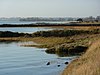 | Y | Y | 2,248.0 hectares (5,555 acres) | PP | Wrabness
51°57′N 1°10′E / 51.95°N 1.16°E / 51.95; 1.16 (Stour Estuary)
TM173327 | EWT,[170] GCR,[171] LNR,[172] NCR,[173] Ramsar,[15] RSPB,[166] SAONB,[167] SPA[174] | Map | Citation | The estuary is nationally important for thirteen species of wintering wildfowl and three on autumn passage, and also for coastal saltmarsh, sheltered muddy shores, two scarce marine invertebrates, rare plant assemblages and three geological sites.[175] |
| Thorndon Park | 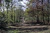 | Y | | 148.5 hectares (367 acres) | YES | Brentwood
51°35′46″N 0°19′26″E / 51.596°N 0.324°E / 51.596; 0.324 (Thorndon Park)
TQ611911 | | Map | Citation | The site is semi-natural woodland and ancient parkland. It has a diverse population of beetles, including one which is rare and threatened in Britain. The parkland has old oak pollards on acid or neutral grassland.[176] |
| Thrift Wood, Woodham Ferrers | 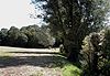 | Y | | 19.5 hectares (48 acres) | YES | Bicknacre
51°41′10″N 0°35′24″E / 51.686°N 0.59°E / 51.686; 0.59 (Thrift Wood, Woodham Ferrers)
TL791018 | EWT[177] | Map | Citation | The site is an ancient semi-natural wood on acid soil. Wild service trees and elders are found in the shrub layer, and a pond has a raised sphagnum bog. Twenty species of butterfly have been recorded.[178] |
| Thundersley Great Common |  | Y | | 9.0 hectares (22 acres) | YES | Thundersley
51°34′26″N 0°35′20″E / 51.574°N 0.589°E / 51.574; 0.589 (Thundersley Great Common)
TQ795893 | | Map | Citation | The site is in two separate areas, and has a variety of grass and heath habitats. There is wet and dry heathland, both unusual in Essex, locally uncommon plants. Ponds which dry up in the summer provide an additional habitat.[179] |
| Tiptree Heath |  | Y | | 24.6 hectares (61 acres) | YES | Tiptree
51°47′53″N 0°43′41″E / 51.798°N 0.728°E / 51.798; 0.728 (Tiptree Heath)
TL882146 | EWT[180] | Map | Citation | This is the largest surviving area of heathland in Essex, and has a number of plants rare in the county. It is dominated by heather and bent grass.[181] A small herd of Dexter cattle help to control the growth of invasive scrub.[180] |
| Turnford and Cheshunt Pits |  | Y | | 174.4 hectares (431 acres) | YES | Waltham Abbey
51°42′22″N 0°01′08″W / 51.706°N 0.019°W / 51.706; -0.019 (Turnford and Cheshunt Pits)
TL370027 | SPA[182] | Map | Citation | This site includes ten former gravel pits, which are of national importance for wintering gadwalls and shovelers. It is also valuable for invertebrates, especially grasshoppers and bush-crickets.[183] |
| Upper Colne Marshes |  | Y | | 113.2 hectares (280 acres) | PP | Wivenhoe
51°51′25″N 0°57′14″E / 51.857°N 0.954°E / 51.857; 0.954 (Upper Colne Marshes)
TM035217 | | Map | Citation | The site has grazing marshes, salt tidal marshes, beaches, sea walls and intertidal mud. It has an important assemblage of nationally scarce plants and diverse ditch types. Insects include the nationally scarce Roesel's bush-cricket.[184] |
| Vange and Fobbing Marshes | 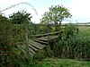 | Y | | 167.3 hectares (413 acres) | YES | Basildon
51°31′55″N 0°29′28″E / 51.532°N 0.491°E / 51.532; 0.491 (Vange and Fobbing Marshes)
TQ729844 TQ725867 | RSPB[185] | Map | Citation | The marshes are unimproved coastal grassland, dykes and creeks, with a wide variety of maritime herbs and grasses, some of them nationally rare. The site is the main British location for least lettuce. Insects with restricted distributions include the scarce emerald damselfly.[186] |
| Waltham Abbey | 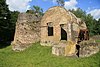 | Y | | 33.8 hectares (84 acres) | YES | Waltham Abbey
51°41′56″N 0°00′43″W / 51.699°N 0.012°W / 51.699; -0.012 (Waltham Abbey)
TL375019 | | Map | Citation | The site is alder woodland on damp soils, with other trees including sycamore, ash and crack willow. The trees were planted around 1700 to provide charcoal for the manufacture of gunpowder, and planting ceased at the time of the First World War.[187] |
| Weeleyhall Wood |  | Y | | 31.6 hectares (78 acres) | YES | Weeley
51°50′42″N 1°07′55″E / 51.845°N 1.132°E / 51.845; 1.132 (Weeleyhall Wood)
TM158209 | EWT[188] | Map | Citation | It has a variety of woodland types, reflecting diverse soils. It is mainly pedunculate oak over a layer of coppice hazel and sweet chestnut planted in the nineteenth century. There are two ponds and species-rich damp, grassy rides.[189] |
| West Thurrock Lagoon and Marshes |  | Y | | 66.5 hectares (164 acres) | PP | West Thurrock
51°27′50″N 0°16′34″E / 51.464°N 0.276°E / 51.464; 0.276 (West Thurrock Lagoon and Marshes)
TQ582763 | | Map | Citation | The site is important for wintering waders and wildfowl which feed on the mudflats. Reed warblers and bearded tits breed on reed beds in the lagoon, and teals and grey herons roost on the shallow waters and grassy islands.[190] |
| West Wood, Little Sampford |  | Y | | 23.9 hectares (59 acres) | YES | Thaxted
51°58′26″N 0°21′25″E / 51.974°N 0.357°E / 51.974; 0.357 (West Wood, Little Sampford)
TL620332 | EWT[191] | Map | Citation | The site is ancient woodland on chalky boulder clay and sandy loam. There is a rich variety of plants in wetter areas, such as oxlip and meadow-sweet.[192] There are many species of birds and butterflies, and four ponds which have great crested newts, dragonflies and damselflies.[191] |
| Wivenhoe Gravel Pit |  | | Y | 1.0 hectare (2.5 acres) | YES | Wivenhoe
51°52′19″N 0°58′37″E / 51.872°N 0.977°E / 51.872; 0.977 (Wivenhoe Gravel Pit)
TM050235 | GCR[193] | Map | Citation | The site is the type locality for the Wivenhoe Gravel, which was laid down by the River Thames before it was diverted south to its present course by the Anglian glaciation around 450,000 years ago. The site is important for establishing the previous course of the Thames.[194] |
| Woodham Walter Common |  | Y | | 79.7 hectares (197 acres) | YES | Danbury
51°43′44″N 0°35′24″E / 51.729°N 0.590°E / 51.729; 0.590 (Woodham Walter Common)
TL790065 | EWT[195] | Map | Citation | The site is on glacial sand and gravel over London Clay. it has a number of areas of oak and hornbeam woodland on former heathland. It also has two botanically rich valleys, each of which has a stream along it.[196] |


