List of Grade I listed buildings in Wiltshire
Map all coordinates using OpenStreetMap
Download coordinates as:
- KML
- GPX (all coordinates)
- GPX (primary coordinates)
- GPX (secondary coordinates)
This is a list of Grade I listed buildings in Wiltshire, England, in the United Kingdom.
These buildings are protected for their historic significance. There is a parallel system for ancient monuments, known as 'scheduling', which means that there is not a consistent approach to sites like castles, abbeys and henges, which may be listed, scheduled or both. In England, the listing is administered by Historic England, an agency of the government's Department for Digital, Culture, Media and Sport.
Buildings of outstanding architectural or historic interest are listed at Grade I, and of the approximately 372,905 listed buildings in England, over 9,000 (2.5%) are Grade I.[1] Estimates to the numbers of buildings do, however, vary given that separate listings apply to structurally separate buildings: therefore a street of houses can be listed as one building, but a church wall can be listed separately from the church. Some buildings are listed for their group value.
This list covers the nearly 300 Grade I listed buildings in the ceremonial county of Wiltshire,[2] grouped by former district.[3] There is a characteristically large contribution from Church of England (Anglican) parish churches, and several great English country houses are included with some of their landscaping features. Several barns are included, and Crofton Pumping Station is associated with water supply.
Salisbury
There are 38 Grade I listed buildings in the city of Salisbury, many of them associated with Salisbury Cathedral.
Borough of Swindon
| Name | Location | Type | Completed [note 1] | Date designated | Grid ref.[note 2] Geo-coordinates | Entry number [note 3] | Image |
|---|---|---|---|---|---|---|---|
| Church of St Swithin | Hinton Parva, Bishopstone | Church | Norman | 26 January 1955 | SU2319883292 51°32′53″N 1°40′01″W / 51.548047°N 1.666848°W / 51.548047; -1.666848 (Church of St Swithin) | 1023270 |  More images |
| Parish Church of St Mary | Bishopstone | Church | 15th century | 26 January 1955 | SU2436583729 51°33′07″N 1°39′00″W / 51.551928°N 1.649988°W / 51.551928; -1.649988 (Parish Church of St Mary) | 1183976 |  More images |
| Parish Church of St Mary | Castle Eaton | Church | 13th century | 26 January 1955 | SU1463895966 51°39′44″N 1°47′23″W / 51.662288°N 1.789768°W / 51.662288; -1.789768 (Parish Church of St Mary) | 1023297 |  More images |
| Church of the Holy Cross | Chiseldon | Church | Anglo-Saxon | 26 January 1955 | SU1871379971 51°31′06″N 1°43′54″W / 51.518353°N 1.731702°W / 51.518353; -1.731702 (Church of the Holy Cross) | 1023312 |  More images |
| Church of St Michael | Highworth | Church | C15 | 26 January 1955 | SU2011692501 51°37′51″N 1°42′39″W / 51.630965°N 1.710769°W / 51.630965; -1.710769 (Church of St Michael) | 1299973 |  More images |
| Church of St John | Inglesham | Church | Saxon | 26 January 1955 | SU2053298431 51°41′03″N 1°42′16″W / 51.684267°N 1.704412°W / 51.684267; -1.704412 (Church of St John) | 1023391 |  More images |
| Church of All Saints | Liddington | Church | 13th century | 26 January 1955 | SU2061981256 51°31′47″N 1°42′15″W / 51.529841°N 1.704158°W / 51.529841; -1.704158 (Church of All Saints) | 1299741 |  More images |
| Church of St Mary Magdalen | South Marston | Church | Medieval | 26 January 1955 | SU1953487991 51°35′26″N 1°43′10″W / 51.590435°N 1.719427°W / 51.590435; -1.719427 (Church of St Mary Magdalen) | 1023403 |  More images |
| Church of St Leonard | Stanton Fitzwarren | Church | Norman | 26 January 1955 | SU1788090119 51°36′35″N 1°44′35″W / 51.609623°N 1.743194°W / 51.609623; -1.743194 (Church of St Leonard) | 1023408 |  More images |
| Church of St Margaret | Stratton St Margaret | Church | 13th century | 26 January 1955 | SU1795687095 51°34′57″N 1°44′32″W / 51.582431°N 1.74225°W / 51.582431; -1.74225 (Church of St Margaret) | 1185393 |  More images |
| Church of St Andrew | Wanborough | Church | 14th century | 26 January 1955 | SU2077282568 51°32′30″N 1°42′07″W / 51.541632°N 1.701876°W / 51.541632; -1.701876 (Church of St Andrew) | 1185526 |  More images |
| Parish Church of St John and St Helen | Wroughton | Church | 14th century | 26 January 1955 | SU1375980257 51°31′16″N 1°48′11″W / 51.521066°N 1.803087°W / 51.521066; -1.803087 (Parish Church of St John and St Helen) | 1355917 |  More images |
| Church of St Mary | Lydiard Park, West Swindon | Church | 17th century | 17 January 1955 | SU1039584772 51°33′42″N 1°51′05″W / 51.561733°N 1.85144°W / 51.561733; -1.85144 (Church of St Mary) | 1023470 |  More images |
| Lydiard Park | West Swindon | Country House | 17th century | 17 January 1955 | SU1037384753 51°33′42″N 1°51′06″W / 51.561563°N 1.851758°W / 51.561563; -1.851758 (Lydiard Park) | 1198420 |  More images |
Trowbridge
| Name | Location | Type | Completed [note 1] | Date designated | Grid ref.[note 2] Geo-coordinates | Entry number [note 3] | Image |
|---|---|---|---|---|---|---|---|
| Lloyd's Bank | Trowbridge | House | c. 1730 | 29 December 1950 | ST8555158077 51°19′18″N 2°12′31″W / 51.321611°N 2.208732°W / 51.321611; -2.208732 (Lloyd's Bank) | 1021586 | 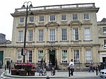 More images |
| Lovemead House | Trowbridge | House | 17th century | 29 December 1950 | ST8587258087 51°19′18″N 2°12′15″W / 51.321709°N 2.204126°W / 51.321709; -2.204126 (Lovemead House) | 1021639 |  More images |
| Midland Bank | Trowbridge | Building | 1727 and 1741 | 29 December 1950 | ST8564958000 51°19′15″N 2°12′26″W / 51.320921°N 2.207322°W / 51.320921; -2.207322 (Midland Bank) | 1284198 |  More images |
| Parade House | Trowbridge | House | c. 1730 | 29 December 1950 | ST8546958067 51°19′17″N 2°12′36″W / 51.321519°N 2.209908°W / 51.321519; -2.209908 (Parade House) | 1364230 |  More images |
| 68 Fore Street | Trowbridge | House | before 1723 | 29 December 1950 | ST8549258090 51°19′18″N 2°12′34″W / 51.321726°N 2.209579°W / 51.321726; -2.209579 (68 Fore Street) | 1021588 |  |
| Parish Church of St James | Trowbridge | Parish Church | Late 15th century | 29 December 1950 | ST8564158064 51°19′17″N 2°12′27″W / 51.321496°N 2.20744°W / 51.321496; -2.20744 (Parish Church of St James) | 1284401 |  More images |
Wiltshire
| Name | Location | Type | Completed [note 1] | Date designated | Grid ref.[note 2] Geo-coordinates | Entry number [note 3] | Image |
|---|---|---|---|---|---|---|---|
| Church of St Michael | Aldbourne | Anglican Church | 6Medieval | 22 August 1966 | SU2638875825 51°28′51″N 1°37′17″W / 51.48077°N 1.621401°W / 51.48077; -1.621401 (Church of St Michael) | 1034152 |  More images |
| Church of St Andrew | Boscombe, Allington | Anglican Church | 17th century | 18 February 1958 | SU2005438562 51°08′46″N 1°42′53″W / 51.145974°N 1.714694°W / 51.145974; -1.714694 (Church of St Andrew) | 1183690 |  More images |
| Church of St Mary | Alton Barnes | Parish Church | C10-C11 | 27 May 1964 | SU1076962027 51°21′26″N 1°50′48″W / 51.357215°N 1.84673°W / 51.357215; -1.84673 (Church of St Mary) | 1364707 | 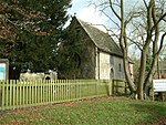 More images |
| Norrington Manor with Wall and Gate Piers | Alvediston | Cross Passage House | Late 14th century | 6 January 1966 | ST9662223806 51°00′49″N 2°02′58″W / 51.013623°N 2.049528°W / 51.013623; -2.049528 (Norrington Manor with Wall and Gate Piers) | 1318666 | 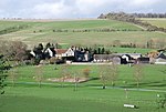 More images |
| Amesbury Abbey | Amesbury | House | 1859 | 10 January 1953 | SU1509741717 51°10′28″N 1°47′08″W / 51.174494°N 1.785425°W / 51.174494; -1.785425 (Amesbury Abbey) | 1131079 | 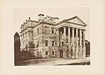 More images |
| Church of St Mary and St Melor | Amesbury | Parish Church, formerly abbey church | 12th century | 18 February 1958 | SU1517641435 51°10′19″N 1°47′04″W / 51.171957°N 1.784307°W / 51.171957; -1.784307 (Church of St Mary and St Melor) | 1182066 | 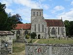 More images |
| West Amesbury House | West Amesbury, Amesbury | House | 15th century | 10 January 1953 | SU1422141491 51°10′21″N 1°47′53″W / 51.172484°N 1.797965°W / 51.172484; -1.797965 (West Amesbury House) | 1318515 |  More images |
| Church of the Holy Cross | Ashton Keynes | Parish Church | 12th century | 17 January 1955 | SU0417094392 51°38′54″N 1°56′28″W / 51.648309°N 1.941128°W / 51.648309; -1.941128 (Church of the Holy Cross) | 1023045 |  More images |
| Barn at Great Chalfield Manor | Great Chalfield (west side), Atworth | Squash Court | 1986 | 13 November 1962 | ST8598463235 51°22′05″N 2°12′10″W / 51.368001°N 2.202723°W / 51.368001; -2.202723 (Barn at Great Chalfield Manor) | 1263048 |  More images |
| Church of All Saints | Great Chalfield (east side), Atworth | Church | 15th century | 13 November 1962 | ST8604563208 51°22′04″N 2°12′07″W / 51.367759°N 2.201846°W / 51.367759; -2.201846 (Church of All Saints) | 1250904 | 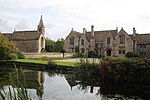 More images |
| Great Chalfield Manor | Great Chalfield (west side), Atworth | House | 16th century | 13 November 1962 | ST8601163195 51°22′04″N 2°12′08″W / 51.367642°N 2.202334°W / 51.367642; -2.202334 (Great Chalfield Manor) | 1250902 | 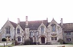 More images |
| Avebury Manor | Avebury | Cross Passage House | c. 1557 | 27 February 1958 | SU0988969997 51°25′44″N 1°51′33″W / 51.428894°N 1.859148°W / 51.428894; -1.859148 (Avebury Manor) | 1033785 | 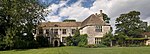 More images |
| Church of St James | Avebury | Church | Anglo Saxon | 22 August 1966 | SU0997669968 51°25′43″N 1°51′28″W / 51.428631°N 1.857898°W / 51.428631; -1.857898 (Church of St James) | 1193084 |  More images |
| Great Barn at Avebury Manor | Avebury | Barn | Restored 1978 | 22 August 1966 | SU1003470034 51°25′45″N 1°51′25″W / 51.429224°N 1.857062°W / 51.429224; -1.857062 (Great Barn at Avebury Manor) | 1286423 | 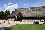 More images |
| Church of St Martin | Barford St Martin | Anglican Church | 16th century | 23 March 1960 | SU0565331388 51°04′54″N 1°55′14″W / 51.081785°N 1.920676°W / 51.081785; -1.920676 (Church of St Martin) | 1146188 |  More images |
| Village Cross to North West of Church of St Martin | Barford St Martin | Village Cross | Probably early medieval | 23 March 1960 | SU0563431409 51°04′55″N 1°55′15″W / 51.081974°N 1.920946°W / 51.081974; -1.920946 (Village Cross to North West of Church of St Martin) | 1182976 | 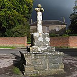 More images |
| Church of St James | Berwick St. James | Anglican Church | 17th century | 23 March 1960 | SU0718239155 51°09′06″N 1°53′55″W / 51.15161°N 1.898696°W / 51.15161; -1.898696 (Church of St James) | 1146243 |  More images |
| Church of St Nicholas | Biddestone | Anglican Church | Mid 19th century | 20 December 1960 | ST8618173547 51°27′39″N 2°12′01″W / 51.460726°N 2.200298°W / 51.460726; -2.200298 (Church of St Nicholas) | 1198839 |  More images |
| Church of St Mary the Virgin | Bishops Cannings | Anglican Church | 13th century | 19 March 1962 | SU0377364181 51°22′36″N 1°56′50″W / 51.376671°N 1.947179°W / 51.376671; -1.947179 (Church of St Mary the Virgin) | 1193298 | 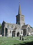 More images |
| Church of St John the Baptist | Bishopstone | Anglican Church | 12th century | 23 March 1960 | SU0843626524 51°02′17″N 1°52′52″W / 51.038014°N 1.881058°W / 51.038014; -1.881058 (Church of St John the Baptist) | 1146195 |  More images |
| Chapel Plaister | Chapel Plaister, Box | Anglican Church | 1985 | 20 December 1960 | ST8399367853 51°24′34″N 2°13′54″W / 51.409471°N 2.231533°W / 51.409471; -2.231533 (Chapel Plaister) | 1250523 |  More images |
| Church of St Christopher | Ditteridge | Anglican Church | 1860 | 20 December 1960 | ST8180269516 51°25′28″N 2°15′47″W / 51.424357°N 2.26312°W / 51.424357; -2.26312 (Church of St Christopher) | 1285201 |  More images |
| Church of St Thomas à Becket | Box | Priests House | Late 14th century or 15th century | 20 December 1960 | ST8230668481 51°24′54″N 2°15′21″W / 51.415067°N 2.255819°W / 51.415067; -2.255819 (Church of St Thomas à Becket) | 1180500 |  More images |
| Hazelbury Manor | Hazelbury Manor, Box | Detached House | 17th century | 20 December 1960 | ST8352868382 51°24′51″N 2°14′18″W / 51.414214°N 2.238243°W / 51.414214; -2.238243 (Hazelbury Manor) | 1363618 |  More images |
| Boyton Manor | Boyton | Country House | 1618 | 11 September 1968 | ST9505739544 51°09′18″N 2°04′19″W / 51.155129°N 2.072057°W / 51.155129; -2.072057 (Boyton Manor) | 1036346 |  More images |
| Church of St Mary | Boyton | Anglican Church | 14th century | 1 July 1986 | ST9504539566 51°09′19″N 2°04′20″W / 51.155326°N 2.072229°W / 51.155326; -2.072229 (Church of St Mary) | 1284200 |  More images |
| Barton Farmhouse | Bradford-on-Avon | Farmhouse | late medieval | 18 April 1952 | ST8233660506 51°20′36″N 2°15′18″W / 51.34336°N 2.254989°W / 51.34336; -2.254989 (Barton Farmhouse) | 1184214 |  More images |
| Belcombe Court | Bradford-on-Avon | Country House | 17th century | 18 April 1952 | ST8173860633 51°20′40″N 2°15′49″W / 51.344483°N 2.26358°W / 51.344483; -2.26358 (Belcombe Court) | 1036018 |  More images |
| Church of St Lawrence | Bradford-on-Avon | Church | 10th century | 18 April 1952 | ST8241960914 51°20′49″N 2°15′14″W / 51.347031°N 2.253817°W / 51.347031; -2.253817 (Church of St Lawrence) | 1036034 |  More images |
| Holy Trinity Church | Bradford-on-Avon | Church | 19th century | 18 April 1952 | ST8241260878 51°20′48″N 2°15′14″W / 51.346707°N 2.253916°W / 51.346707; -2.253916 (Holy Trinity Church) | 1364540 |  More images |
| The Granary at Barton Farm | Bradford-on-Avon | Grange | C14/C15 | 18 April 1952 | ST8234560462 51°20′35″N 2°15′17″W / 51.342965°N 2.254857°W / 51.342965; -2.254857 (The Granary at Barton Farm) | 1036096 |  |
| The Hall | Bradford-on-Avon | House | about 1610 | 18 April 1952 | ST8287060899 51°20′49″N 2°14′50″W / 51.34691°N 2.247341°W / 51.34691; -2.247341 (The Hall) | 1200529 |  More images |
| The Town Bridge and Chapel | Bradford-on-Avon | Bridge and chapel | 13th century | 18 April 1952 | ST8261460892 51°20′49″N 2°15′04″W / 51.34684°N 2.251016°W / 51.34684; -2.251016 (The Town Bridge and Chapel) | 1036011 |  More images |
| Tithe Barn at Barton Farm | Bradford-on-Avon | Tithe Barn | Early 14th century | 18 April 1952 | ST8231760433 51°20′34″N 2°15′19″W / 51.342703°N 2.255258°W / 51.342703; -2.255258 (Tithe Barn at Barton Farm) | 1184239 |  More images |
| Church of St Martin | Bremhill | Anglican Church | 1850 | 20 December 1960 | ST9797273003 51°27′22″N 2°01′50″W / 51.456002°N 2.030578°W / 51.456002; -2.030578 (Church of St Martin) | 1199069 |  More images |
| Church of St Michael | Brinkworth | Anglican Church | 1889 | 28 October 1959 | SU0129284414 51°33′31″N 1°58′58″W / 51.558607°N 1.982758°W / 51.558607; -1.982758 (Church of St Michael) | 1363920 |  More images |
| Church of St Peter and attached Radnor Mausoleum | Britford | Anglican Church | 18th century | 23 March 1960 | SU1628528453 51°03′19″N 1°46′08″W / 51.055192°N 1.769026°W / 51.055192; -1.769026 (Church of St Peter and attached Radnor Mausoleum) | 1023791 |  More images |
| Church of All Saints | Broad Chalke | Church | Medieval | 23 March 1960 | SU0408025347 51°01′39″N 1°56′36″W / 51.027477°N 1.943198°W / 51.027477; -1.943198 (Church of All Saints) | 1146136 |  More images |
| Church of St Peter ad Vincula | Broad Hinton | Church | 6Medieval | 27 February 1958 | SU1053476327 51°29′09″N 1°50′59″W / 51.485798°N 1.849684°W / 51.485798; -1.849684 (Church of St Peter ad Vincula) | 1365589 |  More images |
| Church of St Nicholas | Bromham | Anglican Church | 6Medieval | 19 March 1962 | ST9630965188 51°23′09″N 2°03′16″W / 51.385724°N 2.054429°W / 51.385724; -2.054429 (Church of St Nicholas) | 1033887 |  More images |
| Church of St Mary the Virgin | Broughton Gifford | Church | 14th century | 13 November 1962 | ST8779863127 51°22′01″N 2°10′36″W / 51.367072°N 2.176662°W / 51.367072; -2.176662 (Church of St Mary the Virgin) | 1251257 | 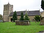 More images |
| Church of St Leonard | Bulford | Anglican Church | 16th century | 18 December 1958 | SU1658043721 51°11′33″N 1°45′51″W / 51.192473°N 1.76412°W / 51.192473; -1.76412 (Church of St Leonard) | 1131034 |  More images |
| Church of St Mary | Calne | Church | c1160-70 | 19 May 1950 | ST9989970905 51°26′14″N 2°00′10″W / 51.437142°N 2.002843°W / 51.437142; -2.002843 (Church of St Mary) | 1271365 | 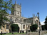 More images |
| Bowood House | Bowood, Calne Without | Country House | 1955–1957 | 5 September 1972 | ST9748169950 51°25′43″N 2°02′15″W / 51.428549°N 2.037622°W / 51.428549; -2.037622 (Bowood House) | 1253268 |  More images |
| The Mausoleum at Bowood House | Bowood, Calne Without | Mausoleum | 1761–65 | 20 December 1960 | ST9612169422 51°25′26″N 2°03′26″W / 51.423794°N 2.057178°W / 51.423794; -2.057178 (The Mausoleum at Bowood House) | 1253402 | 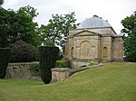 More images |
| Church of St Andrew | Castle Combe | Anglican Church | 19th century | 20 December 1960 | ST8415277189 51°29′36″N 2°13′47″W / 51.49342°N 2.229668°W / 51.49342; -2.229668 (Church of St Andrew) | 1022864 | 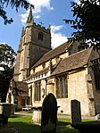 More images |
| Charlton Park House | Charlton Park, Charlton | Country House | c. 1607 | 12 December 1951 | ST9525589175 51°36′05″N 2°04′12″W / 51.601395°N 2.069905°W / 51.601395; -2.069905 (Charlton Park House) | 1022216 |  More images |
| Church of All Saints | Yatesbury, Cherhill | Anglican Church | 1855 | 20 December 1960 | SU0633771490 51°26′33″N 1°54′37″W / 51.442368°N 1.910213°W / 51.442368; -1.910213 (Church of All Saints) | 1363771 |  More images |
| Church of St Peter | Cheverell Magna | Anglican Church | 6Medieval | 19 March 1962 | ST9806454307 51°17′16″N 2°01′45″W / 51.287895°N 2.029146°W / 51.287895; -2.029146 (Church of St Peter) | 1035786 |  More images |
| The Ivy and the Ivy West Wing | Chippenham | House | 1996 | 25 April 1950 | ST9173173199 51°27′28″N 2°07′13″W / 51.457707°N 2.120405°W / 51.457707; -2.120405 (The Ivy and the Ivy West Wing) | 1268171 |  Upload Photo |
| The Yelde Hall and the Council Chamber | Chippenham | Town Hall | Early 15th century | 25 April 1950 | ST9218373234 51°27′29″N 2°06′50″W / 51.458028°N 2.1139°W / 51.458028; -2.1139 (The Yelde Hall and the Council Chamber) | 1267996 |  More images |
| Sheldon Manor | Sheldon Manor, Chippenham Without | Kitchen | 1911 | 20 December 1960 | ST8865874149 51°27′58″N 2°09′53″W / 51.466195°N 2.164665°W / 51.466195; -2.164665 (Sheldon Manor) | 1022907 | 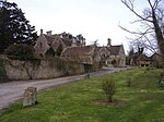 More images |
| Church of St John the Baptist | Chirton | Anglican Church | 6Medieval | 19 March 1962 | SU0734157641 51°19′04″N 1°53′46″W / 51.317831°N 1.896049°W / 51.317831; -1.896049 (Church of St John the Baptist) | 1035807 | 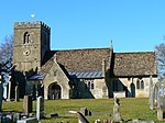 More images |
| Church of All Saints | Christian Malford | Anglican Church | 18th century | 20 December 1960 | ST9599578420 51°30′17″N 2°03′33″W / 51.504698°N 2.059095°W / 51.504698; -2.059095 (Church of All Saints) | 1199647 | 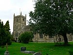 More images |
| Chute Lodge | Chute Forest | Country House | 1768 | 13 June 1988 | SU3094551460 51°15′41″N 1°33′28″W / 51.261465°N 1.557895°W / 51.261465; -1.557895 (Chute Lodge) | 1364573 | Upload Photo |
| Clarendon House | Clarendon Park | House | 1717–1737 | 23 March 1960 | SU1946528541 51°03′21″N 1°43′25″W / 51.055885°N 1.723651°W / 51.055885; -1.723651 (Clarendon House) | 1023949 | Upload Photo |
| St Marie's Grange | Alderbury, Clarendon Park | House | c. 1841 | 9 February 1973 | SU1731728163 51°03′09″N 1°45′16″W / 51.052555°N 1.754316°W / 51.052555; -1.754316 (St Marie's Grange) | 1023953 |  More images |
| Church of St Peter | Clyffe Pypard | Parish Church | 15th century | 17 January 1955 | SU0746076978 51°29′30″N 1°53′38″W / 51.4917°N 1.893941°W / 51.4917; -1.893941 (Church of St Peter) | 1022655 |  More images |
| Church of St John the Baptist | Colerne | Church | Medieval | 20 December 1960 | ST8209371136 51°26′20″N 2°15′32″W / 51.438933°N 2.259017°W / 51.438933; -2.259017 (Church of St John the Baptist) | 1022922 |  More images |
| Church of St Swithin | Compton Bassett | Anglican Church | 1865 | 20 December 1960 | SU0308371599 51°26′36″N 1°57′25″W / 51.443375°N 1.957031°W / 51.443375; -1.957031 (Church of St Swithin) | 1363781 |  More images |
| Compton Park House | Compton Park, Compton Chamberlayne | Country House | 17th century | 23 March 1960 | SU0292230117 51°04′13″N 1°57′35″W / 51.070376°N 1.959673°W / 51.070376; -1.959673 (Compton Park House) | 1146151 | 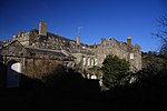 More images |
| Church of St Michael | Coombe Bissett | Anglican Church | Mid 19th century | 23 March 1960 | SU1080426320 51°02′10″N 1°50′50″W / 51.03614°N 1.84729°W / 51.03614; -1.84729 (Church of St Michael) | 1023802 |  More images |
| Church of St Bartholomew | Corsham | Church | c. 1880 | 20 December 1960 | ST8742370549 51°26′02″N 2°10′56″W / 51.433799°N 2.182314°W / 51.433799; -2.182314 (Church of St Bartholomew) | 1021975 | 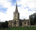 More images |
| Congregational Chapel | Monk's Lane, Corsham | Congregational Chapel | 1662 | 20 December 1960 | ST8765368546 51°24′57″N 2°10′44″W / 51.415794°N 2.178935°W / 51.415794; -2.178935 (Congregational Chapel) | 1363968 |  More images |
| Corsham Court | Corsham Court, Corsham | Country House | 1582 | 20 December 1960 | ST8741570684 51°26′06″N 2°10′57″W / 51.435013°N 2.182434°W / 51.435013; -2.182434 (Corsham Court) | 1022004 | 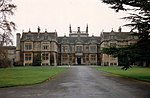 More images |
| Bath House at Corsham Court | Corsham Court, Corsham | Bath House | c1761-1763 | 20 December 1960 | ST8739470859 51°26′12″N 2°10′58″W / 51.436586°N 2.182742°W / 51.436586; -2.182742 (Bath House at Corsham Court) | 1182390 | 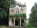 More images |
| Hungerford Almshouses | Corsham | Almshouse | 1668 | 1 August 1986 | ST8732570176 51°25′50″N 2°11′01″W / 51.430443°N 2.18371°W / 51.430443; -2.18371 (Hungerford Almshouses) | 1022101 |  More images |
| Churchyard Cross in Churchyard, Church of St Mary | Cricklade | Cross | 14th century | 17 January 1955 | SU1013893853 51°38′36″N 1°51′18″W / 51.643388°N 1.854887°W / 51.643388; -1.854887 (Churchyard Cross in Churchyard, Church of St Mary) | 1023108 | 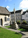 More images |
| Church of St Sampson | Cricklade, Wiltshire | Anglican Church | 19th century | 17 January 1955 | SU0992693537 51°38′26″N 1°51′29″W / 51.64055°N 1.85796°W / 51.64055; -1.85796 (Church of St Sampson) | 1023081 | 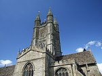 More images |
| Church of All Saints | Crudwell | Anglican Church | 1868 | 28 October 1959 | ST9563892901 51°38′06″N 2°03′52″W / 51.634899°N 2.064423°W / 51.634899; -2.064423 (Church of All Saints) | 1363888 |  More images |
| Church of St James | Dauntsey | Church | 1680 | 28 October 1959 | ST9799382468 51°32′28″N 2°01′49″W / 51.541107°N 2.030333°W / 51.541107; -2.030333 (Church of St James) | 1199909 |  More images |
| Brownston House | Devizes | House | 1720 | 19 September 1972 | SU0054761614 51°21′13″N 1°59′37″W / 51.353601°N 1.993532°W / 51.353601; -1.993532 (Brownston House) | 1251612 |  More images |
| Forecourt Wall of Brownston House | Devizes | Wall | 1720 | 19 September 1972 | SU0053961604 51°21′13″N 1°59′37″W / 51.353511°N 1.993647°W / 51.353511; -1.993647 (Forecourt Wall of Brownston House) | 1251613 | |
| Church of St John the Baptist | Devizes | Church | 6Medieval | 9 April 1954 | SU0046961241 51°21′01″N 1°59′41″W / 51.350247°N 1.994652°W / 51.350247; -1.994652 (Church of St John the Baptist) | 1262359 | 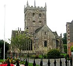 More images |
| Church of St Mary | Devizes | Church | 6Medieval | 9 April 1954 | SU0059861606 51°21′13″N 1°59′34″W / 51.353529°N 1.992799°W / 51.353529; -1.992799 (Church of St Mary) | 1251640 |  More images |
| Devizes Castle including Glass House and Garden Walls encircling West Side of Mound | Devizes | Castle | 12th century | 19 September 1972 | SU0024961342 51°21′04″N 1°59′52″W / 51.351155°N 1.997811°W / 51.351155; -1.997811 (Devizes Castle including Glass House and Garden Walls encircling West Side of Mound) | 1249366 |  More images |
| 17 Market Place | Devizes | House | Early 18th century | 9 April 1954 | SU0029561553 51°21′11″N 1°59′50″W / 51.353052°N 1.997151°W / 51.353052; -1.997151 (17 Market Place) | 1250423 |  |
| Church of St Mary | Dilton Marsh, Old Dilton | Anglican Church | 17th century | 11 September 1968 | ST8586049039 51°14′25″N 2°12′14″W / 51.240351°N 2.203937°W / 51.240351; -2.203937 (Church of St Mary) | 1021476 | 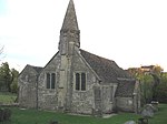 More images |
| Church of St Mary the Virgin | Dinton | Anglican Church | 19th century roof | 23 March 1960 | SU0093231669 51°05′04″N 1°59′17″W / 51.084338°N 1.988071°W / 51.084338; -1.988071 (Church of St Mary the Virgin) | 1146120 | 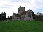 More images |
| Hydes House with attached Walls and Gatepiers | Dinton | House | Earlier | 23 March 1960 | SU0085831713 51°05′05″N 1°59′21″W / 51.084734°N 1.989128°W / 51.084734; -1.989128 (Hydes House with attached Walls and Gatepiers) | 1146122 |  More images |
| Church of St Mary | Donhead St. Mary | Anglican Church | 19th century | 6 January 1966 | ST9067224437 51°01′09″N 2°08′04″W / 51.01923°N 2.134361°W / 51.01923; -2.134361 (Church of St Mary) | 1318792 |  More images |
| Church of St Laurence | Downton | Church | Mid 18th century | 23 March 1960 | SU1811421616 50°59′37″N 1°44′36″W / 50.993659°N 1.743271°W / 50.993659; -1.743271 (Church of St Laurence) | 1023875 |  More images |
| Manor House | Downton | Detached House | Early 14th century | 4 July 1985 | SU1807721663 50°59′39″N 1°44′38″W / 50.994083°N 1.743795°W / 50.994083; -1.743795 (Manor House) | 1023856 |  More images |
| Trafalgar House | Standlynch, Downton | Country House | Shortly before 1766 | 23 March 1960 | SU1859123762 51°00′47″N 1°44′11″W / 51.012941°N 1.736365°W / 51.012941; -1.736365 (Trafalgar House) | 1183796 | 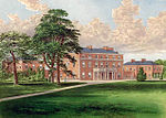 More images |
| The Moot House with attached Kitchen | Downton | House | Early 18th century | 23 March 1960 | SU1822921411 50°59′31″N 1°44′30″W / 50.991812°N 1.741642°W / 50.991812; -1.741642 (The Moot House with attached Kitchen) | 1023898 | 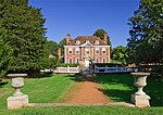 More images |
| Church of St Andrew | Great Durnford, Durnford | Anglican Church | 16th century | 18 February 1958 | SU1364238324 51°08′38″N 1°48′23″W / 51.144021°N 1.806366°W / 51.144021; -1.806366 (Church of St Andrew) | 1182845 |  More images |
| Little Durnford Manor | Little Durnford, Durnford | Manor House | Late 17th century | 10 January 1953 | SU1247534246 51°06′27″N 1°49′23″W / 51.107378°N 1.823188°W / 51.107378; -1.823188 (Little Durnford Manor) | 1284299 |  More images |
| Church of St Mary | East Knoyle | Anglican Church | 1829 | 6 January 1966 | ST8802130532 51°04′26″N 2°10′20″W / 51.073987°N 2.172359°W / 51.073987; -2.172359 (Church of St Mary) | 1131168 | 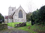 More images |
| Church of St Mary, St Katherine and All Saints | Edington | Church | 1352–1361 | 11 September 1968 | ST9264153314 51°16′44″N 2°06′25″W / 51.27892°N 2.106889°W / 51.27892; -2.106889 (Church of St Mary, St Katherine and All Saints) | 1364257 | 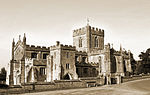 More images |
| Conduit Head (spring) serving Edington Priory | Edington | Spring | 14th century | 11 September 1968 | ST9244152982 51°16′33″N 2°06′35″W / 51.275933°N 2.10975°W / 51.275933; -2.10975 (Conduit Head (spring) serving Edington Priory) | 1181417 |  More images |
| Remains of Abbey or Priory in Grounds of the Monastery Garden at Edington | Edington | Gate | 15th century | 11 September 1968 | ST9269253352 51°16′45″N 2°06′22″W / 51.279263°N 2.106159°W / 51.279263; -2.106159 (Remains of Abbey or Priory in Grounds of the Monastery Garden at Edington) | 1021493 |  More images |
| The Monastery Garden | Edington | House | possibly 16th century | 11 September 1968 | ST9275153384 51°16′46″N 2°06′19″W / 51.279551°N 2.105314°W / 51.279551; -2.105314 (The Monastery Garden) | 1021492 |  More images |
| The Priory | Edington | Detached House | late medieval | 11 September 1968 | ST9260553358 51°16′46″N 2°06′27″W / 51.279316°N 2.107406°W / 51.279316; -2.107406 (The Priory) | 1285064 |  More images |
| Church of All Saints and St Margaret | Enford | Anglican Church | 6Medieval | 27 May 1964 | SU1406151632 51°15′49″N 1°47′59″W / 51.263675°N 1.799859°W / 51.263675; -1.799859 (Church of All Saints and St Margaret) | 1300358 | 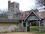 More images |
| Church of All Saints | Fonthill Bishop | Anglican Church | 1871 chancel restoration | 6 January 1966 | ST9347033013 51°05′47″N 2°05′41″W / 51.096386°N 2.094628°W / 51.096386; -2.094628 (Church of All Saints) | 1183785 |  More images |
| Nos 65 and 66 (the Archway) with Flanking Walls | Fonthill Park, Fonthill Bishop | Archway | c. 1860 | 6 January 1966 | ST9332532707 51°05′37″N 2°05′48″W / 51.093632°N 2.096693°W / 51.093632; -2.096693 (Nos 65 and 66 (the Archway) with Flanking Walls) | 1318805 | 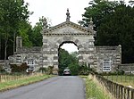 More images |
| Church of St Mary | Great Bedwyn | Anglican Church | 6Medieval | 22 August 1966 | SU2775664277 51°22′37″N 1°36′09″W / 51.376873°N 1.602603°W / 51.376873; -1.602603 (Church of St Mary) | 1365492 |  More images |
| Crofton Pumping Station | Great Bedwyn | Pumping house | 1802–09 | 1 May 1985 | SU2614662269 51°21′32″N 1°37′33″W / 51.358894°N 1.625881°W / 51.358894; -1.625881 (Crofton Pumping Station) | 1034049 | 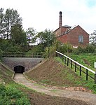 More images |
| Tottenham House | Great Bedwyn | Great House | Pre 1825 | 22 August 1966 | SU2498563926 51°22′26″N 1°38′33″W / 51.373845°N 1.642439°W / 51.373845; -1.642439 (Tottenham House) | 1183809 | 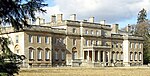 More images |
| Church of St Peter and Paul | Great Somerford | Anglican Church | 1865 | 28 October 1959 | ST9643483100 51°32′48″N 2°03′10″W / 51.546781°N 2.052819°W / 51.546781; -2.052819 (Church of St Peter and Paul) | 1022516 |  More images |
| Church of All Saints | Ham | Anglican Church | 1733–40 | 30 July 1986 | SU3294862924 51°21′52″N 1°31′41″W / 51.364431°N 1.528135°W / 51.364431; -1.528135 (Church of All Saints) | 1300266 |  More images |
| Church of St Giles | Imber, Heytesbury | Anglican Church | 1849 | 11 December 1987 | ST9651148371 51°14′04″N 2°03′05″W / 51.234511°N 2.051356°W / 51.234511; -2.051356 (Church of St Giles) | 1036472 | 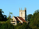 More images |
| Church of St Peter and St Paul | Heytesbury | Anglican Church | 19th century | 11 September 1968 | ST925426 51°10′56″N 2°06′31″W / 51.1823°N 2.1086°W / 51.1823; -2.1086 (Church of St Peter and St Paul) | 1036357 |  More images |
| Early Wing at Brook Hall | Heywood | Farmhouse | Medieval | 11 September 1968 | ST8504753439 51°16′48″N 2°12′57″W / 51.279894°N 2.215768°W / 51.279894; -2.215768 (Early Wing at Brook Hall) | 1285019 |  |
| Church of St Laurence | Hilmarton | Anglican Church | 19th century | 20 December 1960 | SU0199675341 51°28′37″N 1°58′22″W / 51.477026°N 1.972651°W / 51.477026; -1.972651 (Church of St Laurence) | 1300591 |  More images |
| Boathouse and Covered Bridge at Longleat House | Longleat Park, Horningsham | Boat House | c. 1807 | 11 September 1968 | ST8090343138 51°11′14″N 2°16′29″W / 51.187145°N 2.274629°W / 51.187145; -2.274629 (Boathouse and Covered Bridge at Longleat House) | 1200450 | 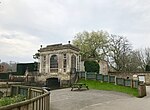 More images |
| Longleat House | Longleat Park, Horningsham, Wiltshire | Country House | 16th century | 11 September 1968 | ST8070543074 51°11′12″N 2°16′39″W / 51.186563°N 2.277458°W / 51.186563; -2.277458 (Longleat House) | 1364361 | 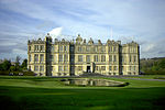 More images |
| Lodge at Longleat House | Longleat Park, Horningsham, Wiltshire | Gate | 1860s | 11 September 1968 | ST8122141913 51°10′34″N 2°16′12″W / 51.176141°N 2.270014°W / 51.176141; -2.270014 (Lodge at Longleat House) | 1200476 | Upload Photo |
| Orangery with walled garden to rear at Longleat House | Longleat Park, Horningsham | Garden Wall | c. 1807 | 11 September 1968 | ST8087643120 51°11′13″N 2°16′30″W / 51.186983°N 2.275014°W / 51.186983; -2.275014 (Orangery with walled garden to rear at Longleat House) | 1036392 |  More images |
| Stables at Longleat House | Longleat Park, Horningsham | Coachmans Cottage | 1968 | 11 September 1968 | ST8077243080 51°11′12″N 2°16′35″W / 51.186619°N 2.2765°W / 51.186619; -2.2765 (Stables at Longleat House) | 1200342 | Upload Photo |
| Bradfield Manor Farmhouse | Hullavington | Farmhouse | 19th century | 12 December 1951 | ST8953583003 51°32′45″N 2°09′08″W / 51.545822°N 2.152306°W / 51.545822; -2.152306 (Bradfield Manor Farmhouse) | 1198808 | Upload Photo |
| Church of St Mary | Hullavington | Anglican Church | 1870 | 28 October 1959 | ST8942882052 51°32′14″N 2°09′14″W / 51.537269°N 2.15382°W / 51.537269; -2.15382 (Church of St Mary) | 1356040 |  More images |
| Church of All Saints | Idmiston | Anglican Church | 1866–67 | 18 February 1958 | SU1971937353 51°08′06″N 1°43′10″W / 51.135114°N 1.719548°W / 51.135114; -1.719548 (Church of All Saints) | 1023956 |  More images |
| Front Boundary Wall with Gateway and Gate Piers at Keevil Manor | Keevil | Gate | c. 1600 | 11 September 1968 | ST9186358081 51°19′18″N 2°07′05″W / 51.321773°N 2.118154°W / 51.321773; -2.118154 (Front Boundary Wall with Gateway and Gate Piers at Keevil Manor) | 1251456 | Upload Photo |
| Front Garden Walls with Archway at Keevil Manor | Keevil | Gate | 1611 | 11 September 1968 | ST9189558122 51°19′20″N 2°07′04″W / 51.322143°N 2.117695°W / 51.322143; -2.117695 (Front Garden Walls with Archway at Keevil Manor) | 1262739 | Upload Photo |
| Keevil Manor with attached Stables | Keevil | House | Circa 1580, porch added 1611, additions & modifications 1912 | 11 September 1968 | ST9191458144 51°19′20″N 2°07′03″W / 51.322341°N 2.117423°W / 51.322341; -2.117423 (Keevil Manor with attached Stables) | 1251455 | Upload Photo |
| Talboys | Keevil | House | Late C14 to mid C15, east wing added 1867 | 11 September 1968 | ST9183858071 51°19′18″N 2°07′07″W / 51.321683°N 2.118512°W / 51.321683; -2.118512 (Talboys) | 1262752 |  More images |
| Church of St Margaret | Knook | Anglican Church | 17th century | 11 September 1968 | ST9374441816 51°10′32″N 2°05′27″W / 51.175545°N 2.090871°W / 51.175545; -2.090871 (Church of St Margaret) | 1285068 |  More images |
| The Manor House | Knook | Detached House | 16th century | 11 September 1968 | ST9374041776 51°10′31″N 2°05′27″W / 51.175186°N 2.090928°W / 51.175186; -2.090928 (The Manor House) | 1364327 |  More images |
| Bewley Court | Lacock | Cross Wing House | Early 15th century | 20 December 1960 | ST9263068509 51°24′56″N 2°06′27″W / 51.415549°N 2.107367°W / 51.415549; -2.107367 (Bewley Court) | 1363958 | Upload Photo |
| Bowden Park | Bowden Hill, Lacock | Country House | 1796 | 20 December 1960 | ST937682 51°24′47″N 2°05′29″W / 51.4131°N 2.0914°W / 51.4131; -2.0914 (Bowden Park) | 1022132 |  More images |
| Church of St Cyriac | Lacock | Anglican Church | 17th century | 20 December 1960 | ST9170868566 51°24′58″N 2°07′14″W / 51.416049°N 2.120626°W / 51.416049; -2.120626 (Church of St Cyriac) | 1198216 | 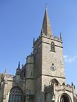 More images |
| Lacock Abbey with stable yard | Lacock Abbey, Lacock | Abbey | 13th century to 15th century | 20 December 1960 | ST9193268418 51°24′53″N 2°07′03″W / 51.414721°N 2.117401°W / 51.414721; -2.117401 (Lacock Abbey with stable yard) | 1283853 |  More images |
| Tithe Barn at Manor Farm | Lacock | Tithe Barn | 14th century | 20 December 1960 | ST9165668458 51°24′54″N 2°07′17″W / 51.415077°N 2.121371°W / 51.415077; -2.121371 (Tithe Barn at Manor Farm) | 1198376 |  More images |
| Church of St Peter | Langley Burrell Without | Anglican Church | 1890 | 20 December 1960 | ST9276775794 51°28′52″N 2°06′20″W / 51.481054°N 2.105548°W / 51.481054; -2.105548 (Church of St Peter) | 1199423 | 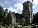 More images |
| Church of St John the Baptist | Latton with Eisey, Latton | Anglican Church | 1858–63 | 17 January 1955 | SU0932995797 51°39′39″N 1°51′59″W / 51.66088°N 1.866527°W / 51.66088; -1.866527 (Church of St John the Baptist) | 1284123 |  More images |
| Milford Mill Bridge | Milford, Laverstock | Bridge | 14th century | 28 February 1952 | SU1575829765 51°04′01″N 1°46′35″W / 51.067004°N 1.776489°W / 51.067004; -1.776489 (Milford Mill Bridge) | 1242884 |  More images |
| Church of St Michael | Little Bedwyn | Anglican Church | 19th century | 22 August 1966 | SU2912466199 51°23′39″N 1°34′58″W / 51.394086°N 1.582792°W / 51.394086; -1.582792 (Church of St Michael) | 1184327 | 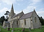 More images |
| Church of St John the Baptist | Little Somerford | Church | c. 1860 | 28 October 1959 | ST9672584368 51°33′29″N 2°02′55″W / 51.558184°N 2.048635°W / 51.558184; -2.048635 (Church of St John the Baptist) | 1300525 |  More images |
| Church of Saint Mary and Saint Ethelbert | Luckington | Anglican Church | 18th century | 28 October 1959 | ST8373284047 51°33′18″N 2°14′10″W / 51.55507°N 2.236036°W / 51.55507; -2.236036 (Church of Saint Mary and Saint Ethelbert) | 1199767 |  More images |
| Biddesden House | Ludgershall | Country House | 1710–11 | 4 June 1952 | SU2952951007 51°15′27″N 1°34′42″W / 51.257467°N 1.578225°W / 51.257467; -1.578225 (Biddesden House) | 1035997 | 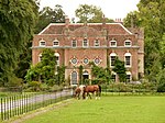 More images |
| Church of St James | Ludgershall | Church | 6Medieval | 27 May 1964 | SU2631450885 51°15′23″N 1°37′27″W / 51.256526°N 1.624305°W / 51.256526; -1.624305 (Church of St James) | 1036004 | 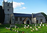 More images |
| Church of All Saints | Maiden Bradley with Yarnfield | Anglican Church | 18th century | 6 January 1966 | ST8036438657 51°08′49″N 2°16′56″W / 51.146834°N 2.282095°W / 51.146834; -2.282095 (Church of All Saints) | 1318479 |  More images |
| Malmesbury Abbey | Malmesbury | Abbey | 675–705 | 18 January 1949 | ST9328087320 51°35′05″N 2°05′54″W / 51.584695°N 2.098384°W / 51.584695; -2.098384 (Malmesbury Abbey) | 1269316 |  More images |
| Abbey House and attached Rear Wall at Malmesbury Abbey | Malmesbury | House | c. 1540 | 18 January 1949 | ST9334087379 51°35′07″N 2°05′51″W / 51.585227°N 2.09752°W / 51.585227; -2.09752 (Abbey House and attached Rear Wall at Malmesbury Abbey) | 1269325 |  More images |
| Court House to rear of No 27, St Johns St. and attached Wall | Malmesbury | Abbey | 1623 | 18 January 1949 | ST9353086969 51°34′54″N 2°05′41″W / 51.581542°N 2.09477°W / 51.581542; -2.09477 (Court House to rear of No 27, St Johns St. and attached Wall) | 1269247 | 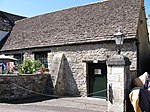 More images |
| St Pauls Bell Tower | Malmesbury | House | Before c1623 | 18 January 1949 | ST9325287237 51°35′02″N 2°05′56″W / 51.583949°N 2.098787°W / 51.583949; -2.098787 (St Pauls Bell Tower) | 1269428 | 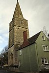 More images |
| Malmesbury Market Cross | Malmesbury | Market Cross | Late 15th century to Early 16th century | 18 January 1949 | ST9330287228 51°35′02″N 2°05′53″W / 51.583868°N 2.098065°W / 51.583868; -2.098065 (Malmesbury Market Cross) | 1269291 | 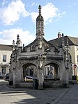 More images |
| The Old Bell Hotel and Attached Front Area Walls and Railings | Malmesbury | Abbey | Early 13th century | 18 January 1949 | ST9322587331 51°35′05″N 2°05′57″W / 51.584794°N 2.099178°W / 51.584794; -2.099178 (The Old Bell Hotel and Attached Front Area Walls and Railings) | 1269521 |  More images |
| Church of St Peter | Manningford Bruce, Manningford | Anglican Church | 1882 | 27 May 1964 | SU1396458025 51°19′16″N 1°48′04″W / 51.321161°N 1.801001°W / 51.321161; -1.801001 (Church of St Peter) | 1300103 | 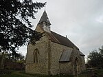 More images |
| Church of All Saints | Marden | Anglican Church | 1885 | 19 March 1962 | SU0862057876 51°19′12″N 1°52′40″W / 51.319926°N 1.877691°W / 51.319926; -1.877691 (Church of All Saints) | 1035827 |  More images |
| Church of St Mary | Market Lavington | Anglican Church | c. 1860 | 19 March 1962 | SU0140454134 51°17′11″N 1°58′53″W / 51.286341°N 1.981252°W / 51.286341; -1.981252 (Church of St Mary) | 1035835 |  More images |
| The Old House | Market Lavington | Aisled House | Early 14th century | 19 March 1962 | SU0147454202 51°17′13″N 1°58′49″W / 51.286953°N 1.980248°W / 51.286953; -1.980248 (The Old House) | 1035851 |  More images |
| Marlborough College: C House (Main Block) | Marlborough | College | 7Early Modern. 18C | 18 July 1949 | SU1848468684 51°25′01″N 1°44′08″W / 51.416874°N 1.735589°W / 51.416874; -1.735589 (Marlborough College: C House (Main Block)) | 1273163 | 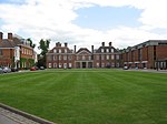 More images |
| Parish Church of St Mary | Marlborough | Church | 1091 | 18 July 1949 | SU1891969244 51°25′19″N 1°43′45″W / 51.421895°N 1.729304°W / 51.421895; -1.729304 (Parish Church of St Mary) | 1034302 | 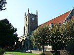 More images |
| Beanacre Old Manor | Beanacre, Melksham Without | Manor House | Late 14th century | 13 February 1985 | ST9016165783 51°23′28″N 2°08′34″W / 51.391°N 2.142793°W / 51.391; -2.142793 (Beanacre Old Manor) | 1021755 | Upload Photo |
| Church of St Michael the Archangel | Mere | Anglican Church | Post 1499 | 6 January 1966 | ST8111132252 51°05′21″N 2°16′16″W / 51.089266°N 2.271078°W / 51.089266; -2.271078 (Church of St Michael the Archangel) | 1130755 |  More images |
| Woodlands Manor | Mere | Manor House | Mid 14th century | 6 January 1966 | ST8150231174 51°04′47″N 2°15′56″W / 51.079586°N 2.26544°W / 51.079586; -2.26544 (Woodlands Manor) | 1200753 | Upload Photo |
| Church of St John the Baptist | Mildenhall | Sundial | C18-C19 | 22 August 1966 | SU2099469476 51°25′26″N 1°41′58″W / 51.423909°N 1.699449°W / 51.423909; -1.699449 (Church of St John the Baptist) | 1365445 |  More images |
| Fyfield Manor | Fyfield, Milton Lilbourne | House | 16th century | 4 June 1952 | SU1759460540 51°20′37″N 1°44′56″W / 51.343675°N 1.748788°W / 51.343675; -1.748788 (Fyfield Manor) | 1286502 | Upload Photo |
| Church of St Leonard | Upper Minety, Minety | Anglican Church | 1896 | 28 October 1959 | SU0095291177 51°37′10″N 1°59′16″W / 51.619416°N 1.987646°W / 51.619416; -1.987646 (Church of St Leonard) | 1363901 |  More images |
| Monkton Farleigh Manor | Monkton Farleigh | Country House | Probably Late 16th century | 13 November 1962 | ST8062865584 51°23′20″N 2°16′47″W / 51.388963°N 2.279788°W / 51.388963; -2.279788 (Monkton Farleigh Manor) | 1364109 |  More images |
| Remains of the Refectory at Monkton Farleigh Manor | Monkton Farleigh | Cluniac Monastery | 1125 | 13 November 1962 | ST8058565608 51°23′21″N 2°16′49″W / 51.389178°N 2.280408°W / 51.389178; -2.280408 (Remains of the Refectory at Monkton Farleigh Manor) | 1021833 | Upload Photo |
| Church of All Saints | Netheravon | Anglican Church | 19th century | 27 May 1964 | SU1478848395 51°14′04″N 1°47′22″W / 51.23455°N 1.789572°W / 51.23455; -1.789572 (Church of All Saints) | 1033956 | 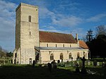 More images |
| Church of St Mary the Virgin | Nettleton, Burton | Anglican Church | 1960 | 20 December 1960 | ST8160979375 51°30′47″N 2°15′59″W / 51.512997°N 2.266412°W / 51.512997; -2.266412 (Church of St Mary the Virgin) | 1022949 | 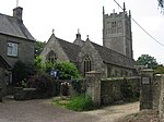 More images |
| Wilbury House | Newton Tony | House | c1710/12-1725 | 10 January 1953 | SU2217341401 51°10′17″N 1°41′03″W / 51.171424°N 1.684228°W / 51.171424; -1.684228 (Wilbury House) | 1300348 |  More images |
| Church of St James | North Wraxall | Anglican Church | Late 18th century | 20 December 1960 | ST8180375064 51°28′27″N 2°15′48″W / 51.474242°N 2.263392°W / 51.474242; -2.263392 (Church of St James) | 1022991 | 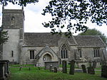 More images |
| Parish Church | Foxley, Norton | Anglican Church | c. 1708 | 28 October 1959 | ST8969885953 51°34′20″N 2°09′00″W / 51.572349°N 2.150042°W / 51.572349; -2.150042 (Parish Church) | 1023219 |  More images |
| Church of All Saints | Oaksey | Anglican Church | 1633 | 28 October 1959 | ST9909193630 51°38′29″N 2°00′52″W / 51.641471°N 2.014533°W / 51.641471; -2.014533 (Church of All Saints) | 1022262 |  More images |
| Longford Castle | Longford Park, Odstock | Castle | 1591 | 23 March 1960 | SU1714026670 51°02′21″N 1°45′25″W / 51.039135°N 1.756912°W / 51.039135; -1.756912 (Longford Castle) | 1355742 |  More images |
| Church of St Andrew | Ogbourne St Andrew | Anglican Church | 15th century | 27 February 1958 | SU1883472345 51°26′59″N 1°43′49″W / 51.449781°N 1.730362°W / 51.449781; -1.730362 (Church of St Andrew) | 1033854 |  More images |
| Barn at Hallam Farm Buildings | Southend, Ogbourne St. George | Barn | C20 | 2 September 1986 | SU1986073704 51°27′43″N 1°42′56″W / 51.461965°N 1.715522°W / 51.461965; -1.715522 (Barn at Hallam Farm Buildings) | 1284436 | Upload Photo |
| Church of St John the Baptist | Pewsey | Anglican Church | 1861 | 27 May 1964 | SU1636759897 51°20′17″N 1°45′59″W / 51.33793°N 1.766433°W / 51.33793; -1.766433 (Church of St John the Baptist) | 1035703 | 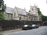 More images |
| Church of All Saints | Farley, Pitton and Farley | Anglican Church | 1688–90 | 23 March 1960 | SU2244129591 51°03′55″N 1°40′52″W / 51.065219°N 1.681125°W / 51.065219; -1.681125 (Church of All Saints) | 1135703 | 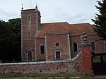 More images |
| The Almshouses (Fox's Hospital) | Farley, Pitton and Farley | House | 1688–90 | 23 March 1960 | SU2244429524 51°03′53″N 1°40′52″W / 51.064616°N 1.681087°W / 51.064616; -1.681087 (The Almshouses (Fox's Hospital)) | 1135704 | 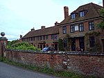 More images |
| Church of St Mary | Potterne | Anglican Church | 1598 | 19 March 1962 | ST9954758542 51°19′34″N 2°00′28″W / 51.325978°N 2.007887°W / 51.325978; -2.007887 (Church of St Mary) | 1258968 |  More images |
| Porch House | Potterne | House | 1874 | 19 March 1962 | ST9949158452 51°19′31″N 2°00′31″W / 51.325169°N 2.008691°W / 51.325169; -2.008691 (Porch House) | 1273182 | 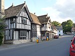 More images |
| Church of St Mary | Purton | Anglican Church | 1872 | 17 January 1955 | SU0968487173 51°35′00″N 1°51′42″W / 51.583334°N 1.861631°W / 51.583334; -1.861631 (Church of St Mary) | 1283956 |  More images |
| Axford Farmhouse | Axford, Ramsbury | Farmhouse | By 1966 | 22 August 1966 | SU2509570284 51°25′52″N 1°38′25″W / 51.431008°N 1.640411°W / 51.431008; -1.640411 (Axford Farmhouse) | 1300471 | 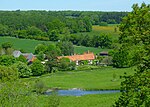 More images |
| Church of the Holy Cross | Ramsbury | Church | 1775 | 22 August 1966 | SU2738271592 51°26′34″N 1°36′27″W / 51.442663°N 1.607414°W / 51.442663; -1.607414 (Church of the Holy Cross) | 1365476 | 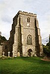 More images |
| Littlecote House | Ramsbury | Courtyard House | c1500-1570 | 22 August 1966 | SU3044670379 51°25′54″N 1°33′48″W / 51.431601°N 1.563434°W / 51.431601; -1.563434 (Littlecote House) | 1300540 |  More images |
| Ramsbury Manor | Ramsbury | Bishops Palace | site of | 22 August 1966 | SU2569570981 51°26′14″N 1°37′54″W / 51.437248°N 1.631731°W / 51.437248; -1.631731 (Ramsbury Manor) | 1184029 |  More images |
| Newhouse | Redlynch | Country House | c. 1619 | 23 March 1960 | SU2182421390 50°59′29″N 1°41′26″W / 50.991499°N 1.690422°W / 50.991499; -1.690422 (Newhouse) | 1300128 | 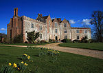 More images |
| Church of the Holy Cross | Seend | Anglican Church | 18th century | 19 March 1962 | ST9441160928 51°20′51″N 2°04′54″W / 51.347404°N 2.081635°W / 51.347404; -2.081635 (Church of the Holy Cross) | 1243604 | 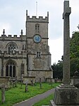 More images |
| Church of St Cosmas and St Damian | Sherrington | Anglican Church | 1624 | 11 September 1968 | ST9603239199 51°09′07″N 2°03′29″W / 51.152034°N 2.058112°W / 51.152034; -2.058112 (Church of St Cosmas and St Damian) | 1364328 |  More images |
| Church of the Holy Cross | Sherston | Anglican Church | 19th century | 28 October 1959 | ST8539286028 51°34′23″N 2°12′44″W / 51.572928°N 2.212176°W / 51.572928; -2.212176 (Church of the Holy Cross) | 1023223 |  More images |
| Manor Farmhouse | South Wraxall | Farmhouse | 1962 | 13 November 1962 | ST8344865597 51°23′21″N 2°14′21″W / 51.38917°N 2.239262°W / 51.38917; -2.239262 (Manor Farmhouse) | 1021854 | Upload Photo |
| South Wraxall Manor, with Garden Wall to South | South Wraxall | Hall House | Early 15th century | 13 November 1962 | ST8331265463 51°23′17″N 2°14′28″W / 51.387961°N 2.241211°W / 51.387961; -2.241211 (South Wraxall Manor, with Garden Wall to South) | 1021853 |  More images |
| Church of St Mary | Stapleford | Anglican Church | 17th century | 23 March 1960 | SU0704937368 51°08′08″N 1°54′02″W / 51.135542°N 1.900631°W / 51.135542; -1.900631 (Church of St Mary) | 1146222 | 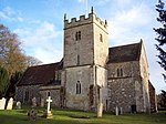 More images |
| Church of St Mary the Virgin | Steeple Ashton | Church | 1670 | 11 September 1968 | ST9064657114 51°18′47″N 2°08′08″W / 51.313059°N 2.135592°W / 51.313059; -2.135592 (Church of St Mary the Virgin) | 1252395 | 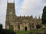 More images |
| Church of All Saints | Steeple Langford | Church | 1635 | 23 March 1960 | SU0364537450 51°08′11″N 1°56′57″W / 51.136311°N 1.949282°W / 51.136311; -1.949282 (Church of All Saints) | 1318701 |  More images |
| Church of St John | Stockton | Anglican Church | 17th century | 11 September 1968 | ST9819638221 51°08′36″N 2°01′38″W / 51.143251°N 2.027167°W / 51.143251; -2.027167 (Church of St John) | 1181597 |  More images |
| Stockton House | Stockton Park, Stockton | Country House | 1580s | 21 July 1950 | ST9768838674 51°08′50″N 2°02′04″W / 51.147323°N 2.034432°W / 51.147323; -2.034432 (Stockton House) | 1284871 |  More images |
| Church of St Peter | Stourton with Gasper | Anglican Church | 1720 | 6 January 1966 | ST7763733945 51°06′16″N 2°19′15″W / 51.104364°N 2.320785°W / 51.104364; -2.320785 (Church of St Peter) | 1318468 |  More images |
| Rockwork Bridge at Stourhead | Stourhead Gardens, Stourton with Gasper | Arch | 1762–1765 | 6 January 1966 | ST7726633837 51°06′12″N 2°19′34″W / 51.103378°N 2.326077°W / 51.103378; -2.326077 (Rockwork Bridge at Stourhead) | 1199172 |  More images |
| St Peter's Pump at Stourhead | Stourhead Park, Stourton with Gasper | Grotto | 18th century | 6 January 1966 | ST7610335399 51°07′03″N 2°20′34″W / 51.117376°N 2.342792°W / 51.117376; -2.342792 (St Peter's Pump at Stourhead) | 1131107 |  More images |
| Stourhead House | Stourhead Park, Stourton with Gasper | Country House | 1721–24 | 6 January 1966 | ST7775434347 51°06′29″N 2°19′09″W / 51.107983°N 2.319139°W / 51.107983; -2.319139 (Stourhead House) | 1131104 |  More images |
| The Bristol High Cross | Stourhead Gardens, Stourton with Gasper | Statue | 1400–1981 | 9 September 1987 | ST7755233964 51°06′16″N 2°19′19″W / 51.104531°N 2.322°W / 51.104531; -2.322 (The Bristol High Cross) | 1318471 |  More images |
| The Convent at Stourhead | Stourhead Park, Stourton with Gasper | House | c. 1765 | 6 January 1966 | ST7568734692 51°06′40″N 2°20′55″W / 51.111001°N 2.348687°W / 51.111001; -2.348687 (The Convent at Stourhead) | 1318474 |  More images |
| The Gothic Cottage at Stourhead | Stourhead Gardens, Stourton with Gasper | Detached House | Probably mid 18th century | 6 January 1966 | ST7711434006 51°06′18″N 2°19′42″W / 51.104892°N 2.328259°W / 51.104892; -2.328259 (The Gothic Cottage at Stourhead) | 1199233 |  More images |
| The Grotto and the River God's Cave at Stourhead | Stourhead Gardens, Stourton with Gasper | Grotto | c. 1748 | 6 January 1966 | ST7714934085 51°06′20″N 2°19′40″W / 51.105603°N 2.327764°W / 51.105603; -2.327764 (The Grotto and the River God's Cave at Stourhead) | 1318473 |  More images |
| The Obelisk at Stourhead | Stourhead Park, Stourton with Gasper | Obelisk | 1746 | 6 January 1966 | ST7732134500 51°06′34″N 2°19′31″W / 51.109342°N 2.325334°W / 51.109342; -2.325334 (The Obelisk at Stourhead) | 1283405 | 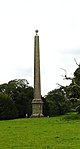 More images |
| The Palladian Bridge at Stourhead | Stourhead Gardens, Stourton with Gasper | Bridge | 1762 | 6 January 1966 | ST7743833952 51°06′16″N 2°19′25″W / 51.104419°N 2.323628°W / 51.104419; -2.323628 (The Palladian Bridge at Stourhead) | 1131099 | 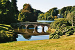 More images |
| The Pantheon at Stourhead | Stourhead Gardens, Stourton with Gasper | Gate | 1753–54 | 6 January 1966 | ST7705933916 51°06′15″N 2°19′45″W / 51.10408°N 2.329039°W / 51.10408; -2.329039 (The Pantheon at Stourhead) | 1131102 |  More images |
| The Paradise Well at Stourhead | Stourhead Gardens, Stourton with Gasper | Urn | Probably late 18th century | 6 January 1966 | ST7741134022 51°06′18″N 2°19′26″W / 51.105047°N 2.324018°W / 51.105047; -2.324018 (The Paradise Well at Stourhead) | 1283514 | Upload Photo |
| The Temple of Apollo at Stourhead | Stourhead Gardens, Stourton with Gasper | Temple | 1765 | 6 January 1966 | ST7738533831 51°06′12″N 2°19′28″W / 51.103329°N 2.324377°W / 51.103329; -2.324377 (The Temple of Apollo at Stourhead) | 1131100 |  More images |
| The Temple of Flora at Stourhead | Stourhead Gardens, Stourton with Gasper | Temple | c. 1772 | 6 January 1966 | ST7742334015 51°06′18″N 2°19′26″W / 51.104985°N 2.323846°W / 51.104985; -2.323846 (The Temple of Flora at Stourhead) | 1318472 | 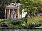 More images |
| Church of St Mary and St Lawrence | Stratford Tony | Anglican Church | 18th century | 23 March 1960 | SU0918426392 51°02′13″N 1°52′13″W / 51.036816°N 1.870393°W / 51.036816; -1.870393 (Church of St Mary and St Lawrence) | 1181901 |  More images |
| Church of St John the Evangelist | Sutton Veny | Anglican Church | 1866–68 | 1 July 1986 | ST9026841721 51°10′29″N 2°08′26″W / 51.174642°N 2.140592°W / 51.174642; -2.140592 (Church of St John the Evangelist) | 1036429 |  More images |
| Church of St Mary | Tidworth | Church (redundant) | 1878 | 7 March 1973 | SU2354147696 51°13′41″N 1°39′51″W / 51.227973°N 1.66425°W / 51.227973; -1.66425 (Church of St Mary) | 1093240 |  More images |
| Church of St Thomas a Becket | Tilshead | Anglican Church | 17th century | 18 February 1958 | SU0348347989 51°13′52″N 1°57′05″W / 51.231078°N 1.951499°W / 51.231078; -1.951499 (Church of St Thomas a Becket) | 1023968 | 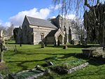 More images |
| Inner Gatehouse at Place Farm | Tisbury | Farmhouse | Late 15th century | 6 January 1966 | ST9511129816 51°04′04″N 2°04′16″W / 51.067654°N 2.07115°W / 51.067654; -2.07115 (Inner Gatehouse at Place Farm) | 1146019 | 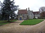 |
| Outer Gatehouse at Place Farm | Tisbury | Gate | 15th century | 6 January 1966 | ST9514229787 51°04′03″N 2°04′15″W / 51.067394°N 2.070707°W / 51.067394; -2.070707 (Outer Gatehouse at Place Farm) | 1300237 | 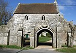 More images |
| Place Farmhouse | Tisbury | Farmhouse | 1966 | 6 January 1966 | ST9510429834 51°04′04″N 2°04′17″W / 51.067816°N 2.07125°W / 51.067816; -2.07125 (Place Farmhouse) | 1184177 |  More images |
| Tithe Barn at Place Farm | Tisbury | Staddle Stone | 15th century | 6 January 1966 | ST9517729840 51°04′04″N 2°04′13″W / 51.067871°N 2.070209°W / 51.067871; -2.070209 (Tithe Barn at Place Farm) | 1318824 |  More images |
| Church of St John the Baptist | Tisbury | Anglican Church | Tower rebuilt 1762 | 6 January 1966 | ST9440829124 51°03′41″N 2°04′52″W / 51.061425°N 2.081172°W / 51.061425; -2.081172 (Church of St John the Baptist) | 1146017 |  More images |
| Old Wardour Castle | Wardour Park, Tisbury | Castle | 1390s | 25 October 1951 | ST9386626336 51°02′11″N 2°05′20″W / 51.03635°N 2.088858°W / 51.03635; -2.088858 (Old Wardour Castle) | 1183429 |  More images |
| New Wardour Castle | Wardour Park, Tisbury | Country House | 1770–76 | 25 October 1951 | ST9279126926 51°02′30″N 2°06′15″W / 51.041642°N 2.104202°W / 51.041642; -2.104202 (New Wardour Castle) | 1146004 |  More images |
| Wardour Castle Chapel | New Wardour Castle, Tisbury | Chapel | 1834 | 6 July 1987 | ST9274726968 51°02′31″N 2°06′17″W / 51.042019°N 2.10483°W / 51.042019; -2.10483 (Wardour Castle Chapel) | 1300093 |  More images |
| Church of St Mary | Upavon | Anglican Church | 1875 | 27 May 1964 | SU1354855038 51°17′40″N 1°48′25″W / 51.294313°N 1.807083°W / 51.294313; -1.807083 (Church of St Mary) | 1365553 |  More images |
| Church of St Augustine (St Peter) with attached Railings | Upton Lovell | Anglican Church | 17th century | 11 September 1968 | ST9448440841 51°10′00″N 2°04′49″W / 51.166786°N 2.080271°W / 51.166786; -2.080271 (Church of St Augustine (St Peter) with attached Railings) | 1181825 |  More images |
| Church of St Michael and All Angels | Urchfont | Anglican Church | 1864 | 19 March 1962 | SU0407357305 51°18′53″N 1°56′35″W / 51.314842°N 1.942946°W / 51.314842; -1.942946 (Church of St Michael and All Angels) | 1364609 |  More images |
| Portway House | Warminster | House | 1722 | 28 April 1952 | ST8735445364 51°12′26″N 2°10′57″W / 51.207342°N 2.182405°W / 51.207342; -2.182405 (Portway House) | 1364442 |  More images |
| Borbach Chantry | West Dean | Chantry Chapel | 1333 | 23 March 1960 | SU2558127454 51°02′45″N 1°38′11″W / 51.045872°N 1.636466°W / 51.045872; -1.636466 (Borbach Chantry) | 1184418 |  More images |
| Church of All Saints | West Lavington | Anglican Church | 1847 | 19 March 1962 | SU0064553031 51°16′35″N 1°59′32″W / 51.276425°N 1.992137°W / 51.276425; -1.992137 (Church of All Saints) | 1198014 |  More images |
| Parish Church of All Saints | Westbury | Church | 1747 | 29 December 1950 | ST8737551430 51°15′43″N 2°10′56″W / 51.261887°N 2.18232°W / 51.261887; -2.18232 (Parish Church of All Saints) | 1180510 | 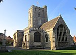 More images |
| Church of St Mary the Virgin | Westwood | Anglican Church | 15th century | 13 November 1962 | ST8121659014 51°19′48″N 2°16′16″W / 51.329909°N 2.270989°W / 51.329909; -2.270989 (Church of St Mary the Virgin) | 1180693 |  More images |
| Westwood Manor | Westwood | Manor House | 15th century | 13 November 1962 | ST8122459039 51°19′48″N 2°16′15″W / 51.330134°N 2.270875°W / 51.330134; -2.270875 (Westwood Manor) | 1285342 |  More images |
| Oare House | Oare | House | 1740 | 4 June 1952 | SU1559763012 51°21′57″N 1°46′38″W / 51.36596°N 1.777351°W / 51.36596; -1.777351 (Oare House) | 1035754 |  More images |
| Lake House | Wilsford cum Lake | House | 1578 | 10 January 1953 | SU1339138961 51°08′59″N 1°48′36″W / 51.149755°N 1.80993°W / 51.149755; -1.80993 (Lake House) | 1183238 |  More images |
| Casino at Wilton House | Wilton Park, Wilton | Casino | 1757–1762 | 4 August 1951 | SU0977630533 51°04′27″N 1°51′43″W / 51.074042°N 1.861839°W / 51.074042; -1.861839 (Casino at Wilton House) | 1199840 | Upload Photo |
| Church of St Mary and St Nicholas | Wilton | Church | 19th century | 4 August 1951 | SU0948231288 51°04′51″N 1°51′58″W / 51.080836°N 1.866016°W / 51.080836; -1.866016 (Church of St Mary and St Nicholas) | 1365914 | 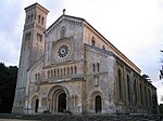 More images |
| Column of Venus Genetrix at Wilton House | Wilton Park, Wilton | Column | C3 AD | 8 June 1978 | SU1030330862 51°04′37″N 1°51′16″W / 51.076992°N 1.854308°W / 51.076992; -1.854308 (Column of Venus Genetrix at Wilton House) | 1199991 |  More images |
| Holbein Porch at Wilton House | Wilton Park, Wilton | Summerhouse | 1951 | 4 August 1951 | SU0965030996 51°04′42″N 1°51′49″W / 51.078208°N 1.863625°W / 51.078208; -1.863625 (Holbein Porch at Wilton House) | 1199912 | Upload Photo |
| Loggia to west of Wilton House with rear wall and approach steps and quadrants | Wilton Park, Wilton | Wall | c. 1826 | 4 August 1951 | SU0988831011 51°04′42″N 1°51′37″W / 51.078339°N 1.860227°W / 51.078339; -1.860227 (Loggia to west of Wilton House with rear wall and approach steps and quadrants) | 1023768 | Upload Photo |
| Palladian Bridge at Wilton House | Wilton Park, Wilton | Bridge | 1736–1737 | 4 August 1951 | SU0997530854 51°04′37″N 1°51′32″W / 51.076925°N 1.85899°W / 51.076925; -1.85899 (Palladian Bridge at Wilton House) | 1023763 |  More images |
| Park School House at Wilton House | Wilton Park, Wilton | Grotto | c. 1635 | 4 August 1951 | SU1017231154 51°04′47″N 1°51′22″W / 51.07962°N 1.856169°W / 51.07962; -1.856169 (Park School House at Wilton House) | 1200089 | Upload Photo |
| The Almonry at Wilton House | Wilton Park, Wilton | Almonry | 14th century or 15th century | 4 August 1951 | SU0987331077 51°04′44″N 1°51′38″W / 51.078932°N 1.86044°W / 51.078932; -1.86044 (The Almonry at Wilton House) | 1365922 | Upload Photo |
| The Riding School at Wilton House | Wilton Park, Wilton | Pavilion | Before 1800 | 4 August 1951 | SU0990431066 51°04′44″N 1°51′36″W / 51.078833°N 1.859998°W / 51.078833; -1.859998 (The Riding School at Wilton House) | 1199905 | Upload Photo |
| Triumphal Entrance Arch and Flanking Lodges at Wilton House | Wilton Park, Wilton | Gate | 18th century | 4 August 1951 | SU0994331086 51°04′44″N 1°51′34″W / 51.079012°N 1.85944°W / 51.079012; -1.85944 (Triumphal Entrance Arch and Flanking Lodges at Wilton House) | 1365920 |  More images |
| Washern Grange at Wilton House | Wilton Park, Wilton | House | Modern | 4 August 1951 | SU0976730690 51°04′32″N 1°51′43″W / 51.075454°N 1.861963°W / 51.075454; -1.861963 (Washern Grange at Wilton House) | 1023764 | Upload Photo |
| Wilton House | Salisbury, Wilton | Courtyard House | After 1544, finished 1563 | 4 August 1951 | SU0993330976 51°04′41″N 1°51′35″W / 51.078023°N 1.859586°W / 51.078023; -1.859586 (Wilton House) | 1023762 |  More images |
| Dundas Aqueduct | Dundas, Winsley | Aqueduct | c. 1805 | 14 June 1988 | ST7846862530 51°21′41″N 2°18′38″W / 51.361425°N 2.310644°W / 51.361425; -2.310644 (Dundas Aqueduct) | 1215193 |  More images |
| Church of St Mary the Virgin | Winterbourne Gunner, Winterbourne, Wiltshire | Anglican Church | c. 1687 | 18 February 1958 | SU1805535357 51°07′02″N 1°44′36″W / 51.117221°N 1.74343°W / 51.117221; -1.74343 (Church of St Mary the Virgin) | 1184486 |  More images |
| Church of St Katherine and St Peter | Winterbourne Bassett | Anglican Church | 14th century | 27 February 1958 | SU1013874908 51°28′23″N 1°51′20″W / 51.473047°N 1.855428°W / 51.473047; -1.855428 (Church of St Katherine and St Peter) | 1284298 |  More images |
| Heale House | Heale House, Woodford | House | 1571 | 10 January 1953 | SU1285736405 51°07′36″N 1°49′04″W / 51.126783°N 1.817655°W / 51.126783; -1.817655 (Heale House) | 1183383 |  More images |
| Church of St Margaret of Antioch | Yatton Keynell | Anglican Church | 19th century | 20 December 1960 | ST8661976361 51°29′10″N 2°11′39″W / 51.486039°N 2.194102°W / 51.486039; -2.194102 (Church of St Margaret of Antioch) | 1356103 |  More images |
| Zeals House | Lower Zeals, Zeals | Country House | Late 14th century | 9 September 1987 | ST7963431908 51°05′10″N 2°17′32″W / 51.086122°N 2.292147°W / 51.086122; -2.292147 (Zeals House) | 1318497 |  More images |
See also
- Category:Grade I listed buildings in Wiltshire
- List of Grade I listed buildings in Salisbury
- Grade II* listed buildings in Wiltshire
Notes
- ^ a b c The date given is the date used by Historic England as significant for the initial building or that of an important part in the structure's description.
- ^ a b c Sometimes known as OSGB36, the grid reference is based on the British national grid reference system used by the Ordnance Survey.
- ^ a b c The "List Entry Number" is a unique number assigned to each listed building and scheduled monument by Historic England.
References and footnotes
- ^ "Listed Buildings". English Heritage. 2010. Archived from the original on 26 January 2013. Retrieved 26 August 2011.
- ^ "Search the List – Advanced Search". Historic England. Retrieved 19 August 2020.
- ^ Wiltshire became a unitary authority in April 2009, alongside Swindon, so these districts are historic
External links
![]() Media related to Grade I listed buildings in Wiltshire at Wikimedia Commons
Media related to Grade I listed buildings in Wiltshire at Wikimedia Commons
- v
- t
- e
- Bedfordshire
- Berkshire
- Bristol
- Buckinghamshire
- Cambridgeshire
- Cheshire
- Cornwall
- Cumbria
- Derbyshire
- Devon
- Dorset
- Durham
- East Sussex
- East Riding of Yorkshire
- Essex
- Gloucestershire
- Greater London
- Greater Manchester
- Hampshire
- Herefordshire
- Hertfordshire
- Isle of Wight
- Kent
- Lancashire
- Leicestershire
- Lincolnshire
- Merseyside
- Norfolk
- North Yorkshire
- Northamptonshire
- Northumberland
- Nottinghamshire
- Oxfordshire
- Rutland
- Shropshire
- Somerset
- South Yorkshire
- Staffordshire
- Suffolk
- Surrey
- Tyne and Wear
- Warwickshire
- West Midlands
- West Sussex
- West Yorkshire
- Wiltshire
- Worcestershire
- Babergh
- Bath and North East Somerset
- Bradford
- Brighton and Hove
- Broadland
- Cheltenham
- Cheshire East
- Cheshire West and Chester
- Cotswold
- Craven
- Dartford
- Dover
- Forest Heath
- Forest of Dean
- Ipswich
- Maidstone
- Mendip
- Mid Suffolk
- North Somerset
- Sedgemoor
- South Gloucestershire
- South Somerset
- St Edmundsbury
- Stroud
- Suffolk Coastal
- Taunton Deane
- Tewkesbury
- Waveney
- West Somerset
- Churches
- War memorials
- 20th century


