Dungourney
Village in County Cork, Ireland
Village in Munster, Ireland
Dungourney Dún Guairne | |
|---|---|
Village | |
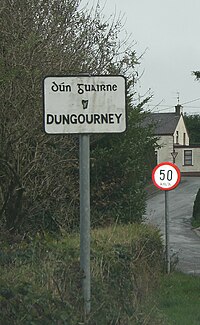 Dungourney from the west | |
| 51°58′10″N 8°05′25″W / 51.969553°N 8.090357°W / 51.969553; -8.090357 | |
| Country | Ireland |
| Province | Munster |
| County | Cork |
| Dáil Éireann | Cork East |
| EU Parliament | South |
| Time zone | UTC+0 (WET) |
| • Summer (DST) | UTC-1 (IST (WEST)) |
| Irish Grid Reference | W930795 |
Dungourney (Irish: Dún Guairne, meaning 'Guairne's fort'[1]) is a village in County Cork, Ireland on the R627 regional road 9 km (5.6 mi) northeast of Midleton. The river Dungourney flows through the village. St. Peter's National School is located in the centre. There is a church in the west of the village and a post office across the road. There are several roads linking to Midleton, Castlemartyr and Tallow.
Sport
Dungourney GAA Club and Dungourney Camogie Club are the local Gaelic games clubs.
The Fitzgibbon Cup, the hurling competition contested by university teams, is named after Dungourney man Fr. Edwin Fitzgibbon. He was born in 1884, and went to school in the area before joining the Capuchin Franciscan Order in 1893. He died in 1938 and was buried at the Capuchin cemetery in Rochestown.[2]
See also
References
- v
- t
- e
Places in County Cork
County town: Cork

Townlands
- Adrigole
- Aghabullogue
- Aghada
- Ahakista
- Aherla
- Ahiohill
- Allihies
- Ardfield
- Ardgroom
- Ballinacurra
- Ballinadee
- Ballinagree
- Ballinascarty
- Ballineen
- Ballingeary
- Ballinhassig
- Ballinora
- Ballinspittle
- Ballintemple
- Ballycotton
- Ballydehob
- Ballydesmond
- Ballygarvan
- Ballylickey
- Ballymakeera
- Ballymore
- Ballyvourney
- Baltimore
- Banteer
- Béal na Bláth
- Belgooly
- Belvelly
- Blarney
- Boherbue
- Bridebridge
- Bweeng
- Canovee
- Carrigadrohid
- Carriganimmy
- Carrigtwohill
- Castlehaven
- Castlelyons
- Castlemagner
- Castlemartyr
- Castletown-Kinneigh
- Castletownbere
- Castletownroche
- Castletownshend
- Churchtown
- Cloghroe
- Clondulane
- Cloughduv
- Cloyne
- Coachford
- Conna
- Coolea
- Courtmacsherry
- Crookhaven
- Crookstown
- Crossbarry
- Crosshaven
- Cullen
- Doneraile
- Douglas
- Drimoleague
- Dripsey
- Dromahane
- Dungourney
- Dunmanway
- Durrus
- Enniskean
- Eyeries
- Farran
- Fermoy
- Fountainstown
- Freemount
- Glandore
- Glanmire
- Glantane
- Glanworth
- Glasheen
- Glenbrook
- Glengarriff
- Glenville
- Glounthaune
- Goleen
- Gougane Barra
- Halfway
- Innishannon
- Kilbrin
- Kilbrittain
- Kilmichael
- Kilnamartyra
- Killumney
- Kilworth
- Kiskeam
- Knockavilla
- Knocknagree
- Knockraha
- Ladysbridge
- Leap
- Liscarroll
- Lisgoold
- Lismire
- Lombardstown
- Lyre
- Mayfield
- Meelin
- Milford
- Minane Bridge
- Mitchelstown
- Monard
- Monkstown
- Montenotte
- Mourneabbey
- Nad
- Newcestown
- Newmarket
- Newtwopothouse
- Nohoval
- Ovens
- Rathbarry
- Rathcormac
- Riverstick
- Roberts Cove
- Rockchapel
- Rosscarbery
- Rylane
- Sallybrook
- Schull
- Shanagarry
- Shanbally
- Shanballymore
- Timoleague
- Togher
- Tower
- Union Hall
- Upton
- Waterfall
- Watergrasshill
- Whitegate
- Mountains
- Ballyhoura Mountains
- Boggeragh Mountains
- Caha Mountains
- Derrynasaggart Mountains
- Galtee Mountains
- Mullaghareirk Mountains
- Shehy Mountains
- Slieve Miskish Mountains
- Rivers
- River Bandon
- River Blackwater
- River Lee
- Heads
- Brow Head
- Mizen Head
- Sheep's Head
- Islands
- Ballycotton Island
- Bere Island
- Cape Clear Island
- Capel Island
- Carbery's Hundred Isles
- Fastnet Rock
- Dursey Island
- Garinish
- Great Island
- Heir Island
- Haulbowline Island
- Inishfarnard
- Long Island
- Sherkin Island
- Spike Island
- Whiddy Island
- Lists of townlands of County Cork
- Mountains and hills of County Cork
- Rivers of County Cork
- Geography of County Cork


